'Hanna' now a typhoon — PAGASA
MANILA, Philippines — Tropical cyclone Hanna further intensified into a typhoon, the Philippine Atmospheric, Geophysical and Astronomical Services Administration (PAGASA) reported on Friday.
The center of Hanna (international name: Haikui) was spotted at 785 kilometers east northeast of Itbayat, Batanes, with maximum sustained winds of 120 kilometers per hour near the center and gustiness of up to 150 kph.
It was forecast to move westward at 20 kph.
Rainfall, winds
According to PAGASA, Hanna is not expected to directly bring heavy rainfall across the country.
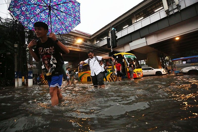
"However, the southwest monsoon currently enhanced by Hanna, Typhoon Saola (Goring), and Severe Tropical Storm Kirogi will bring occasional to monsoon rains over the western portion of Luzon in the next three days," PAGASA said.
Goring, the seventh cyclone of the year for the country, left the Philippine Area of Responsibility (PAR) on Wednesday after affecting northern Luzon with powerful winds and heavy rainfall. Severe Tropical Storm Kirogi is also outside PAR.
The agency issued a warning regarding the possibility of floods and landslides in vulnerable areas and regions that have experienced significant rainfall in the past few days.
PAGASA said that Hanna is not expected to directly bring severe winds but the enhanced southwest monsoon will bring gusty conditions to the following areas throught the day:
- Batanes
- Ilocos Region
- Cordillera Administrative Region
- Zambales
- Bataan
- Aurora
- Bulacan
- Metro Manila
- CALABARZON
- MIMAROPA
- Bicol Region
- Western Visayas
- Northern portion of Eastern Visayas
Hanna's impact on the southwest monsoon has led to a gale warning for coastal areas of Luzon and Western Visayas, as well as the seaboard of northern Samar.
"Disruption in civilian maritime activities is expected over these areas (e.g., suspension of sea travel) due to hazardous sea condition," PAGASA said.
Track, intensity
Hanna is expected to maintain a general west-northwestward to northwestward movement during the forecast period.
"On the track forecast, the tropical cyclone is forecast to pass close or make landfall in the vicinity of Yaeyama Islands in the Ryukyu archipelago between tomorrow afternoon and evening, then make landfall or pass close to the northern portion of Taiwan on Sunday morning," PAGASA said.
Hanna is expected to exit PAR by Sunday morning.


- Latest
- Trending