


‘Mawar’ reintensifies into super typhoon, may bring heavy rains beginning Saturday
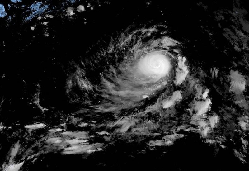
MANILA, Philippines — State weather service PAGASA said Thursday that “Mawar,” the tropical cyclone outside of the Philippine area of responsibility, has become a super typhoon again after a brief weakening as it passed over Guam.
The cyclone which will be named Betty once it enters the PAR is currently packing winds of up to 185 kilometers per hour near the center and gusts of up to 230 kph as it moves west northwestward at 15 kph.
Mawar, last spotted 2,150 kilometers east of southern Luzon, is forecast to enter the PAR on Friday evening or in the early hours of Saturday. PAGASA said it is not ruling out the possibility of hoisting signal warnings as early as Saturday.
The super typhoon is still not directly affecting any part of the country but can bring moderate to intense rains over Cagayan Valley and extreme northern Luzon over the weekend until Monday when the cyclone may be closest to these areas.
Forecast tracks show Mawar might turn northwestward over the weekend and may not make landfall over the country, although PAGASA weather specialist Benison Estareja said the state weather service is not ruling out the possibility that the super typhoon’s eye may hit Cagayan Valley or extreme northern Luzon.
It is also forecast to strengthen the southwest monsoon or habagat which can bring heavy rains over the western sections of southern Luzon, Visayas and Mindanao in the next two days and continuing over to the next week.
“As it moves nearer to our area, it’s possible that it may cause huge waves over the eastern seaboard of the country and may gradually enhance habagat or the southwest monsoon” Estraeja said.
Mawar is forecast to maintain its strength as a super typhoon as it traverses the Philippine Sea, but may weaken into a typhoon as it approaches extreme northern Luzon.


- Latest
- Trending


