Super Typhoon Henry continues to slow down
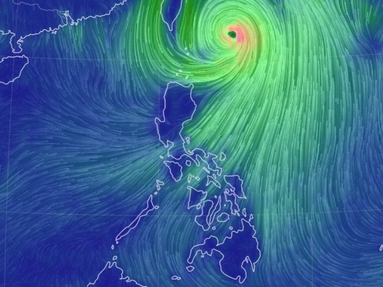
MANILA, Philippines — Super Typhoon Henry (international name: Hinnamnor) continued to slow down on Friday over the Philippine Sea east of Batanes, according to state weather bureau PAGASA.
As of 5:00 a.m., the typhoon’s eye was traced at 395 kilometers east northeast of Basco, Batanes. Moving almost stationary, it is only packing maximum sustained winds of 175 kilometers per hour near the center and gustiness of up to 215 kph.
Tropical Cyclone Wind Signal No. 1 is still hoisted over Batanes, Babuyan Islands, and the northeastern portion of mainland Cagayan (Santa Ana). The possibility of raising Wind Signal No. 2 is not yet ruled out, PAGASA said.
Areas under Signal No. 1 will experience strong winds or strong breeze to near gale strength.
What to expect
Henry may bring moderate to heavy rains with at times intense over Batanes, Babuyan Islands, Ilocos Norte and Abra on Friday, PAGASA said. It is expected to bring light to moderate with at times heavy rains over Cagayan and the rest of Ilocos Region and Cordillera Administrative Region on Friday.
By Saturday, moderate to heavy rains may affect Batanes while light to moderate with at times heavy rains are possible over Babuyan Islands.
The weather bureau said that Henry is forecast the southwest moonsoon, which may bring rains over the western section of Luzon beginning Saturday.
PAGASA issued gale warning for the northern and eastern seaboards of northern Luzon.
The tropical cyclone may bring moderate to rough seas over the eastern seaboards of central Luzon and southern Luzon (1.2 to 3.0 m), which may be risky for those using small sea vessels.
Henry is expected to remain "almost stationary" on Friday morning before tracking slowly northwestward later in the afternoon.
"On the forecast track, Henry will eventually accelerate northward tomorrow and exit the Philippine Area of Responsibility on tomorrow evening or Sunday morning," PAGASA said.
"This typhoon is forecast to weaken while in its quasi-stationary phase. A short period of intensification may also take place outside the PAR region by Sunday as Henry tracks northward over the East China Sea," it added.
Forecast position
- Sept. 2, 2022 02:00 p.m. - 375 km east northeast of Itbayat, Batanes
- Sept. 3, 2022 02:00 a.m. - 350 km east northeast of Itbayat, Batanes
- Sept. 3, 2022 02:00 p.m. - 420 km northeast of Itbayat, Batanes
- Sept. 4, 2022 02:00 a.m. - 565 km north northeast of Itbayat, Batanes (outside PAR)
- Sept. 4, 2022 02:00 p.m. - 725 km north northeast of Itbayat, Batanes (outside PAR)
- Sept. 5, 2022 02:00 a.m. - 915 km north northeast of extreme northern Luzon (outside PAR)


- Latest
- Trending