'Fabian' intensifies as it moves west northwestward
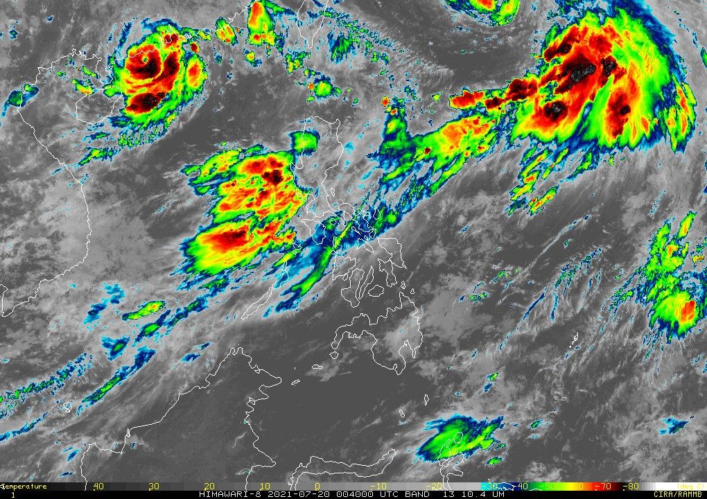
MANILA, Philippines — PAGASA on Tuesday said Severe Tropical Storm "Fabian" (In-fa) slightly picked up strength, bringing an increasing likelihood for storm signal to be raised in Batanes and Babuyan Islands.
The weather bureau in its 11 a.m. bulletin said Fabian was last seen at 960 km east northeast of extreme northern Luzon.
It now packs 100 kilometers per hour peak winds, and gusts of up to 125 kph.
Fabian, the sixth storm to enter the Philippines this year, now moves west northwestward at a speed of 10 kph.
Weather forecasters said it is still unlikely to bring heavy rainfall in the country. But the development could see Batanes and Babuyan Islands soon under Signal No. 1.
"Residents and disaster managers [are] advised to continuously monitor the tropical cyclone bulletins," PAGASA said.
These areas will also experience monsoon rains in the next 24 hours from the southwest monsoon enhanced by Fabian and a typhoon outside the country:
- Metro Manila
- Ilocos Region
- Cordillera Administrative Region
- Zambales
- Bataan
- Pampanga
- Cavite
- Batangas
- Occidental Mindoro
- Northern Palawan, including Calamian and Cuyo Islands
- Batanes
- Babuyan Islands
Rough to very rough seas will also be felt over the seaboards of Batanes and Babuyan Islands, as well as over the western seaboard of Palawan (including Kalayaan and Calamian Islands), and Occidental Mindoro (including Lubang Islands).
"Sea travel is risky for small seacrafts over these waters," the agency said. "Mariners without the proper experience should immediately seek safe harbor."
Fabian is now seen to exit the Philippine Area of Responsibility by Friday evening or early Saturday morning.
Forecast Position
- Wednesday morning: 725 km northeast of extreme northern Luzon
- Thursday morning: 500 km northeast of Itbayat, Batanes
- Friday morning: 425 km north northeast of Itbayat, Batanes
- Saturday morning: 485 km north of Itbayat, Batanes or West of Taipei City, Taiwan (Outside PAR)


- Latest
- Trending