'Wutip' weakens into tropical storm ahead of PAR entry
February 28, 2019 | 11:59am
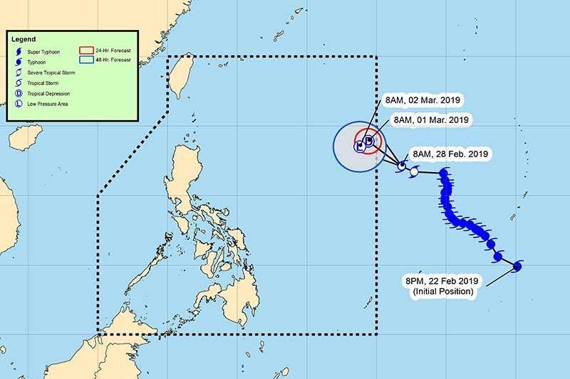
The eye of Wutip was last seen at 1,540 kilometers east of northern Luzon. It is moving west northwest at 20 km per hour.
PAGASA
MANILA, Philippines — “Wutip” has downgraded from a typhoon into a tropical storm ahead of its entry to the Philippine area of responsibility.
In a bulletin, state weather bureau PAGASA said the eye of Wutip was last seen at 1,540 kilometers east of northern Luzon. It is moving west northwest at 20 kilometers per hour.
"Wutip" carries maximum sustained winds of 80 kilometers per hour near the center and gusts of up to 95 kph.
The tropical storm is forecast to enter the country’s jurisdiction between Thursday night and Wednesday early morning. Once it is inside PAR, Wutip will be named “Betty.”
“Wutip poses no direct threat to any part of the country,” PAGASA said.
Forecast positions and intensities
- Friday morning: 1,345 km east of Aparri, Cagayan (tropical depression)
- Saturday morning: 1,285 km east of Aparri, Cagayan (low pressure area)
— Gaea Katreena Cabico
BrandSpace Articles


<
>
Philstar
x
- Latest
- Trending
Trending
Latest
Trending

By Cecille Suerte Felipe | 1 day ago


By Ian Laqui | 11 hours ago

By Ian Laqui | 19 hours ago

14 hours ago

Latest


By Cecille Suerte Felipe | 4 hours ago

4 hours ago

By Patrick Miguel | 4 hours ago

By Cecille Suerte Felipe | 4 hours ago

Recommended

19 hours ago

4 days ago

4 days ago

5 days ago