'Aghon' strengthens, 18 areas now under Signal No. 1
MANILA, Philippines — More areas in Luzon, Visayas and Mindanao were placed under Tropical Cyclone Wind Signal No. 1 due to Aghon as the tropical depression slightly strengthened, the state weather bureau said Friday.
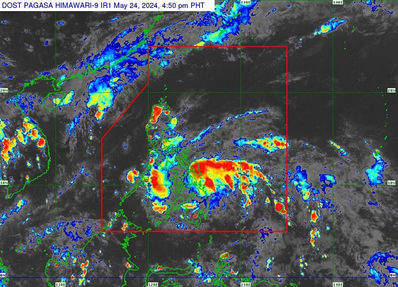
Aghon—the first tropical cyclone to enter the Philippine area of responsibility—was last spotted 135 kilometers northeast of Hinatuan, Surigao del Sur or 185 km east Southeast of Surigao City, Surigao del with peak winds of 55 kilometer per hour near the center and gusts of up to 70 kph.
It was heading west northwestward at 30 kph.
The following areas were placed under Signal No. 1:
Luzon
- Sorsogon
- Albay
- Catanduanes
- Camarines Sur
- Camarines Norte (San Vicente, San Lorenzo Ruiz, Basud, Daet, Talisay, Mercedes)
- Masbate including Ticao and Burias Islands
Visayas
- Eastern Samar
- Samar
- Northern Samar
- Leyte
- Southern Leyte
- Biliran
- Cebu (San Remigio, Tabogon, City of Bogo, Medellin, Daanbantayan, Borbon) including Camotes Islands, Bantayan Islands
- Bohol (Pres. Carlos P. Garcia, Bien Unido, Trinidad, Anda, Candijay, Ubay, Mabini, Alicia, San Miguel, Talibon)
Mindanao
- Dinagat Islands
- Surigao del Norte including Siargao and Bucas Grande Islands,
- Surigao del Sur
- Agusan del Sur (Sibagat, City of Bayugan, Prosperidad, San Francisco, Rosario, Bunawan, Trento),
- Agusan del Norte
Residents of these areas may experience minimal to minor impacts from strong winds.
Heavy rainfall outlook
Aghon is steadily moving west northwestward over the sea east of Mindanao, bringing significant rainfall and potential hazards to various regions in the country.
From Friday until Saturday afternoon:
- 100-200 mm: Albay, Sorsogon, Eastern Visayas, Surigao del Norte, Dinagat Islands
- 50-100 mm: Southern Quezon, Masbate (including Ticao and Burias Islands), Catanduanes, eastern Camarines Sur, Western Visayas, Surigao del Sur, Zamboanga del Norte
From Saturday afternoon to Sunday afternoon:
- 100-200 mm: Bicol Region, Northern Samar
- 50-100 mm: Rest of Eastern Visayas, southern Quezon, Polillo Islands
From Sunday afternoon to Monday afternoon:
- 50-100 mm: Catanduanes, Camarines Norte, Camarines Sur, southern Quezon, Polillo Islands
"Forecast rainfall are generally higher in elevated or mountainous areas," PAGASA said.
"Under these conditions, flooding and rain-induced landslides are possible especially in areas that are highly or very highly susceptible to these hazards as identified in hazard maps and in localities that experienced considerable amounts of rainfall for the past several days," it added.
Hazards affecting coastal waters
On Friday afternoon, Aghon will bring moderate to rough seas (1.5 to 3.5 meters) along the northern and eastern seaboards of Eastern Visayas and the eastern seaboard of the Caraga Region.
Mariners operating motor bancas and similarly-sized vessels are advised to take precautionary measures and avoid navigating these waters if possible, especially if inexperienced or operating ill-equipped vessels.
Track and intensity outlook
Aghon is expected to move generally west northwestward or northwestward from Friday until Saturday while slowly intensifying.
"It is expected to make landfall over the southern portion of Eastern Samar or Dinagat Islands by tomorrow morning as a tropical storm," the state weather bureau said.
"Afterwards, Aghon will pass north northwestward through the coast of Northern Samar and may make another landfall over the southeastern portion of the Bicol Region (Sorsogon, Albay, or Catanduanes) by tomorrow evening as a tropical storm," it added.
Forecast position
- May 25, 2024 2:00 a.m.: In the coastal waters of Guiuan, Eastern Samar
- May 25, 2024 2:00 p.m.: In the vicinity of Gandara, Samar
- May 26, 2024 2:00 a.m.: In the vicinity of Goa, Camarines Sur
- May 26, 2024 2:00 p.m.: 180 km east northeast of Infanta, Quezon
- May 27, 2024 2:00 a.m.: 170 km east of Casiguran, Aurora
- May 27, 2024 2:00 p.m.: 270 km east of Tuguegarao City, Cagayan
- May 28, 2024 2:00 p.m.: 665 km east northeast of Itbayat, Batanes
- May 29, 2024 2:00 p.m. 1,670 km northeast of extreme Northern Luzon (outside PAR)


- Latest
- Trending