'Paeng' crosses Cavite; Signal No. 3 up in 12 areas
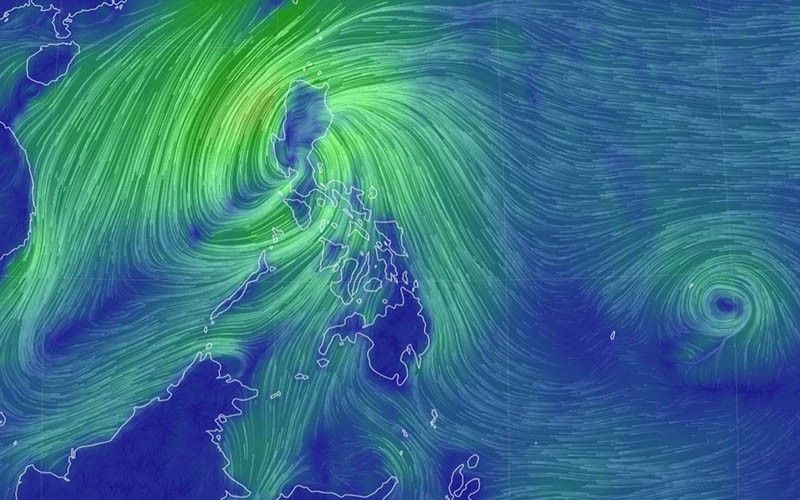
MANILA, Philippines — Severe Tropical Storm Paeng (international name: Nalgae) has maintained its strength as it passes over Cavite, the 8:00 p.m. bulletin of state weather bureau PAGASA said.
Paeng was last located in the vicinity of General Mariano Alvarez, Cavite, as it moves westward at 20 kph. The severe tropical storm is packing maximum sustained winds of 95 kph near the center and gustiness of up to 115 kph.
LIVE UPDATES: Severe Tropical Storm Paeng
PAGASA said Paeng is forecast to track west northwestward through Sunday morning. It will traverse Cavite area then cross the southern portion of Bataan.
It warned that the storm may maintain its strength as it moves across Luzon landmass and may further intensify once it emerges over the West Philippine Sea.
Earlier Saturday, Paeng made landfall over Buenavista, Quezon, then over Santa Cruz, Marinduque and over Sariaya, Quezon.
The National Disaster Risk Reduction and Management Council recommended to President Ferdinand “Bongbong” Marcos Jr. to declare a state of calamity for up to a year due to impacts of Paeng.
READ: What does a declaration of a state of calamity do?
What to expect
State meteorologists warned that Metro Manila, Bataan, Zambales, Calabarzon, Marinduque, Mindoro provinces and the northern portion of Palawan including Calamian and Cuyo islands are expected to experience heavy to intense with at times torrential rains this evening.
“Moderate to heavy with at times intense rains likely over Camarines Provinces, Isabela, Aurora, the rest of MIMAROPA, Ilocos Region, and Cordillera Administrative Region,” PAGASA added.
Meanwhile, the rest of Luzon and Visayas can expect an evening with light to moderate with at times heavy rains.
For Sunday, October 30, Pagasa said Zambales, Bataan and Ilocos region may experience moderate to heavy with at times intense rains.
Meanwhile, Metro Manila, Cordillera Administrative Region, MIMAROPA, CALABARZON and the rest of Central Luzon may expect light to moderate with at times heavy rains for the day.
“Under these conditions, widespread flooding and rain-induced landslides are expected, especially in areas that are highly or very highly susceptible to these hazard as identified in hazard maps and in localities with significant antecedent rainfall,” PAGASA said
Metro Manila remains under Tropical Cyclone Wind Signal No. 3 in the latest update of PAGASA.
TCWS No. 3 (Winds between 89 kph to 117 kph may be expected in at least 18 hours)
- The central and southern portions of Zambales (San Marcelino, Subic, Olongapo City, Castillejos, San Antonio, San Narciso, San Felipe, Cabangan, Botolan)
- Bataan
- the southern portion of Bulacan (Hagonoy, Paombong, City of Malolos, Bulacan, Obando, City of Meycauayan)
- the western portion of Pampanga (Masantol, Macabebe, Sasmuan, Lubao, Floridablanca, Porac)
- Metro Manila
- the southwestern portion of Quezon (City of Tayabas, Lucena City, Lucban, Sariaya, Candelaria, Dolores, Tiaong, San Antonio)
- Laguna
- Batangas
- Cavite
- Rizal
- the northwestern portion of Occidental Mindoro (Paluan, Abra de Ilog) including Lubang Islands
- the northwestern portion of Oriental Mindoro (San Teodoro, Puerto Galera, Baco, City of Calapan)
TCWS No. 2 (Winds between 62 kph to 88 kph may be expected in at least 24 hours)
- Pangasinan
- the southern portion of Aurora (San Luis, Baler, Dingalan, Maria Aurora)
- Tarlac
- Nueva Ecija
- the rest of Bulacan
- the rest of Pampanga
- the rest of Zambales
- the central portion of Oriental Mindoro (Socorro, Gloria, Bansud, Victoria, Bongabong, Pinamalayan, Pola, Naujan)
- the central portion of Mindoro (Sablayan, Mamburao, Santa Cruz)
- Marinduque
- the northern portion of Romblon (Concepcion, Corcuera, Banton)
- the western and central portions of Camarines Norte (Santa Elena, Labo, Capalonga, Jose Panganiban, Paracale, San Vicente, San Lorenzo Ruiz, Daet, Vinzons, Talisay)
- the western portion of Camarines Sur (Del Gallego, Ragay)
- the rest of Quezon including Pollilo Islands
TCWS No. 1 (Winds between 39 kph to 61 kph may be expected in at least 36 hours or intermittent rains may be expected within 36 hours)
Luzon
- La Union
- Kalinga
- Abra
- Benguet
- Ifugao
- Ilocos Sur
- Mountain Province
- Isabela
- Nueva Vizcaya
- Quirino
- the rest of Aurora
- Catanduanes
- Albay
- Sorsogon
- Masbate including Ticao and Burias Islands
- the rest of Romblon
- the rest of Camarines Sur
- the rest of Camarines Norte
- the rest of Occidental Mindoro
- the rest of Oriental Mindoro
- the northern portion of Palawan (El Nido, Taytay, Dumaran, Araceli, Roxas, San Vicente) including Calamian and Cuyo Islands
Visayas
- The western portion of Northern Samar (Lope de Vega, Rosario, Biri, San Isidro, Capul, San Vicente, Victoria, Lavezares, San Antonio, Mondragon, San Jose, Pambujan, Catarman, San Roque, Allen, Bobon, Silvino Lobos)
- the northwestern portion of Samar (Calbayog City, Santa Margarita, Gandara, Pagsanghan, Tarangnan, Santo Nino, Almagro, Tagapul-An)
- the northwestern portion of Leyte (Calubian, San Isidro)
- the northern portion of Biliran (Maripipi, Kawayan, Almeria, Naval, Culaba)
- the extreme northern portion of Cebu (Medellin, Daanbantayan) including Bantayan Islands
- the northern portion of Negros Occidental (Sagay City, Cadiz City, City of Escalante, Manapla, Enrique B. Magalona, City of Victorias, Silay City, City of Talisay, Murcia, Bacolod City, Bago City, Pulupandan, San Carlos City, Salvador Benedicto, Calatrava, Toboso, Valladolid, La Carlota City)
- Guimaras
- Capiz
- Iloilo
- Aklan
- Antique
Paeng’s forecast position
- Oct 30, 2022 05:00 AM - 120 km West Northwest of Iba, Zambales
- Oct 30, 2022 05:00 PM - 300 km West of Iba, Zambales
- Oct 31, 2022 05:00 AM - 390 km West of Dagupan City, Pangasinan
- Oct 31, 2022 05:00 PM - 435 km West of Sinait, Ilocos Sur (OUTSIDE PAR)
- Nov 1, 2022 05:00 AM - 460 km West of Laoag City, Ilocos Norte (OUTSIDE PAR)
- Nov 1, 2022 05:00 PM - 575 km West of Calayan, Cagayan (OUTSIDE PAR)
- Nov 2, 2022 05:00 PM - 760 km West of Basco, Batanes (OUTSIDE PAR)
- Nov 3, 2022 05:00 PM - 1,025 km West of Extreme Northern Luzon (OUTSIDE PAR)


- Latest
- Trending