


Tropical depression seen to enter PAR Thursday
MANILA, Philippines (Updated, 11:56 a.m.) — The tropical depression outside the Philippine Area of Responsibility may enter the country’s jurisdiction Thursday, the state weather bureau said.
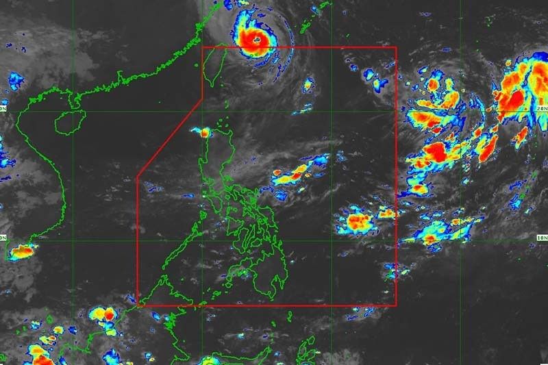
In a bulletin issued past 11 a.m., PAGASA said the cyclone was seen 1,740 kilometers east of Extreme Northern Luzon.
The tropical depression packed peak winds of 55 kph near the center and gusts of up to 70 kph. It was heading north slowly.
According to the weather forecaster, the cyclone may enter the PAR region Thursday afternoon or evening. It will be called “Josie” once inside PAR.
“This tropical cyclone may intensify into tropical storm within 24 hours. By Thursday, improving environmental conditions will enable the tropical cyclone to intensify at a relatively faster rate,” PAGASA said, adding the cyclone may enter PAR as a typhoon.
It is expected to remain far from the Philippine landmass and not directly affect the country’s weather condition.
However, it may enhance rains over the western sections of Southern Luzon and Visayas beginning Wednesday or Thursday.
Inday exits PAR
Meanwhile, Typhoon Inday (Muifa) left PAR at 12:40 a.m.
PAGASA said it is “unlikely to directly bring heavy rains in the country.”
However, gusty conditions reaching strong to gale-force strength will continue to affect Extreme Northern Luzon due to the channeling of the typhoon circulation in the Luzon Strait.
A gale warning also remains in effect for the seaboards of Batanes and Babuyan Islands due to the influence of Inday. — Gaea Katreena Cabico
Track of tropical depression
- September 13, 8 PM: 1,775 km east of Extreme Northern Luzon (outside PAR)
- September 14, 8 AM: 1,795 km east of Extreme Northern Luzon (outside PAR)
- September 14, 8 PM: 1,750 km east northeast of Extreme Northern Luzon (outside PAR)
- September 15, 8 AM: 1,605 km east northeast of Extreme Northern Luzon (outside PAR)
- September 15, 8 PM: 1,440 km east northeast of Extreme Northern Luzon (outside PAR)
- September 16, 8 AM: 1,280 km east northeast of Extreme Northern Luzon (outside PAR)
- September 17, 8 AM: 1,080 km northeast of Extreme Northern Luzon (outside PAR)
- September 18, 8 AM: 1,195 km north northeast of Extreme Northern Luzon (outside PAR)


- Latest
- Trending


