


DENR seeks public participation to verify Philippine mangrove map
MANILA, Philippines — The Department of Environment and Natural Resources (DENR) on Monday urged Filipinos to become citizen scientists by helping validate the government’s map of the country’s mangrove forests.
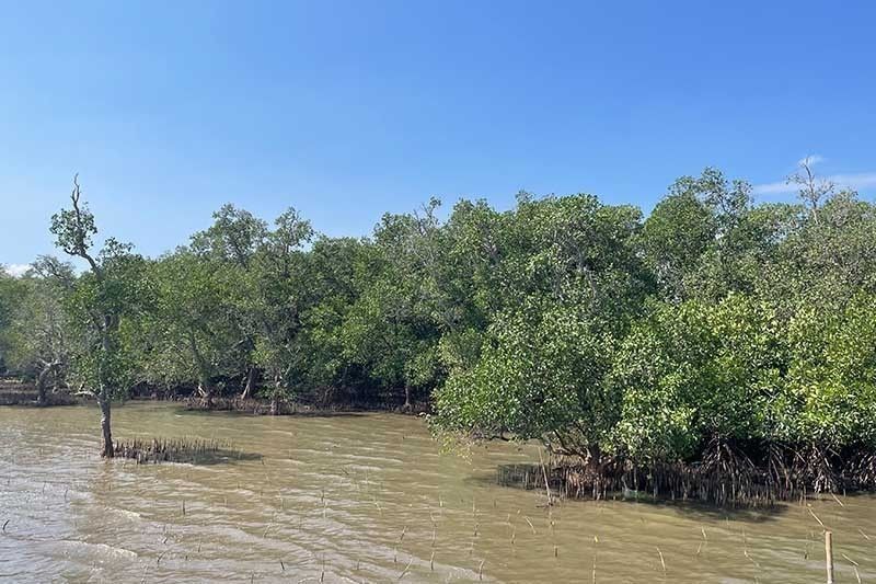
Environment Secretary Maria Antonia Yulo-Loyzaga said the public can play an active role in mangrove rehabilitation and conservation by validating the national mangrove map, which was developed by the DENR and the Philippine Space Agency (PhilSA) using satellite data.
To verify the map’s accuracy and enhance its reliability, it must be validated through on-the-ground data.
The DENR set an ambitious target to finalize the field validation of the national mangrove map by June 2024. The process will involve visiting over 600 sites and collecting data from 30,000 validation points across the archipelago.
However, the project has received less than 5% of the targeted submissions, highlighting the urgent need for increased public participation.
“Amid the climate emergency and destruction of mangroves, everyone has the ability to make a difference by tracking and protecting our natural resources,” Yulo-Loyzaga said.
Mangroves are crucial in the fight against climate change because they serve as natural barriers to storms and absorb planet-heating carbon. Mangroves also provide nursery habitat for marine species and improve water quality.
Validation process
The DENR called on the private and public sectors to visit coastal villages and verify the presence or absence of mangroves. The application ODK Collect is available in the Google Play Store to facilitate data collection.
PhilSA has pre-identified specific barangays and suggests collecting 50 mangrove and 50 non-mangrove data points within each village. Data collection in barangays not initially specified is also welcome. A 10-meter minimum distance between points is preferred.
Those with drones can submit drone images of mangroves.
Validating the national mangrove map is crucial for quantifying and understanding the true value of the Philippines' natural resources, according to the DENR.
The department earlier ordered the assessment of abandoned, undeveloped, and underutilized (AUU) fishponds in Bicol region, Western Visayas, and Zamboanga Peninsula to identify potential areas for mangrove restoration.
More than half of the Philippines’ extensive mangrove ecosystems, estimated at 450,000 hectares in 1918, have been lost primarily to fishpond conversion and other coastal development projects.


- Latest


