PAGASA: No major rain threat due to ‘Aghon’ as it moves away
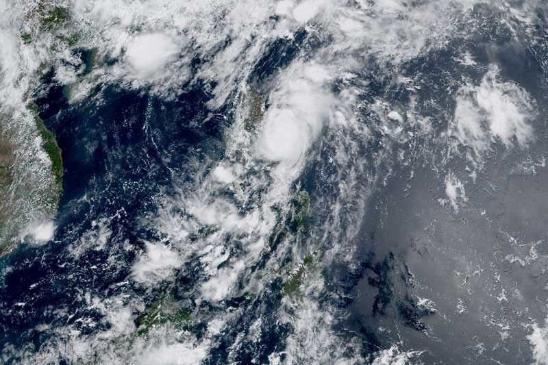
MANILA, Philippines — Typhoon Aghon (international name: Ewiniar) is unlikely to directly bring significant rainfall in the coming days as it continues to move away from the Philippines, PAGASA said on Monday.
The state weather bureau reported that Aghon was last spotted 100 kilometers east southeast of Casiguran in Aurora, with peak winds of 140 km per hour near the center and gusts of up to 170 kph.
It was heading northeastward over the Philippine Sea at 10 kph.
Wind signals remained hoisted over the following areas:
Signal No. 2 (Winds between 62 kph and 88 kph may be expected in at least 24 hours)
- Southeastern portion of Isabela (Dinapigue, Palanan)
- Northern portion of Aurora (Dilasag, Casiguran)
Residents of areas under Signal No. 2 could experience minor to moderate impacts from gale-force winds
Signal No. 1 (Winds between 39 and 61 kph may be expected in at least 36 hours or intermittent rains may be expected within 36 hours)
- Northeastern and southern portions of Isabela (Divilacan, San Mariano, San Guillermo, Jones, Echague, San Agustin, Ilagan City, Benito Soliven, City of Cauayan, Maconacon, Angadanan, Naguilian)
- Eastern portion of Quirino (Maddela, Nagtipunan, Aglipay)
- Southern portion of Nueva Vizcaya (Alfonso Castaneda)
- Rest of Aurora
- Northern portion of Quezon (General Nakar, Infanta, Real) including Polillo Islands
- Northwestern portion of Camarines Norte (Paracale, Jose Panganiban, Vinzons, Capalonga) including Calaguas Islands
Residents of areas under Signal No. 1 could experience minimal to minor impacts from strong winds.
The National Disaster Risk Reduction and Management Council on Monday reported that seven people in Bicol region were injured by trees toppled by Aghon. Meanwhile, almost 20,000 individuals were affected by the country’s first cyclone this year.
What to expect
PAGASA said that Aghon “is less likely to directly bring significant amounts of rainfall within the next three days.”
However, the cyclone enhances the southwesterly wind flow, which will bring moderate to heavy rains over Western Visayas and parts of MIMAROPA in the next two days.
Sea travel is risky for small seacrafts, including all motor bancas, over the coastal waters of southern Cagayan, Isabela, Aurora and the northern coastal waters of Quezon province, including Polillo Islands, due to Aghon.
It will also cause moderate to rough seas (1.5 to 3 meters) over the eastern coastal waters of Cagayan and the northern coastal waters of Bicol region.
The weather agency said that Aghon will continue to intensify over the next two days as it moves northeastward over the Philippine Sea.
It may exit the Philippine Area of Responsibility on Wednesday afternoon or evening as a typhoon.
Forecast position
- May 27, 2024 8:00 p.m. - 225 km east southeast of Tuguegarao City, Cagayan
- May 28, 2024 8:00 a.m. - 460 km east of Calayan, Cagayan
- May 28, 2024 8:00 p.m. - 700 km east of Basco, Batanes
- May 29, 2024 8:00 a.m. - 1,015 km east northeast of extreme Northern Luzon
- May 29, 2024 8:00 p.m. - 1,280 km east northeast of extreme Northern Luzon (outside PAR)
- May 30, 2024 8:00 a.m. - 1,600 km east northeast of extreme Northern Luzon (outside PAR)
— Gaea Katreena Cabico


- Latest
- Trending