Signal No. 2 lifted, but 'Paeng' will still bring wind, rain to parts of Luzon
MANILA, Philippines — Tropical Cyclone Wind Signal No. 2 has been lifted in all areas in Northern Luzon as Tropical Storm Paeng (international name: Nalgae) moves west-southward while maintaining strength.
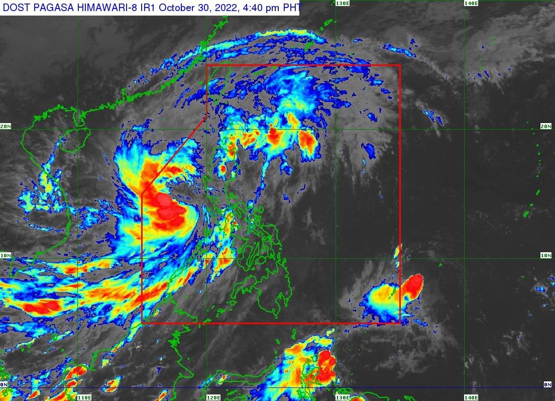
According to PAGASA’s 5 p.m. bulletin, Paeng’s center was last located 295 kilometers west of Iba, Zambales, moving west southwestward at 20 km per hour with winds going at 85 kph and gusts of up to 105 kph. It is expected to exit the Philippine monitoring area by Monday morning or afternoon.
Areas in Luzon remain under Tropical Cyclone Wind Signal No. 1 and may experience winds of from 39 to 61 kph and intermittent rains in the next 36 hours:
- Cagayan, including Babuyan Islands
- Isabela
- Quirino
- Nueva Vizcaya
- Apayao
- Abra
- Kalinga
- Mountain Province
- Ifugao
- Benguet
- Ilocos Norte
- Ilocos Sur
- La Union
- Pangasinan
- Aurora
- Bulacan
- Nueva Ecija
- Tarlac
- Pampanga
- Bataan
- Zambales
- Metro Manila
- West and central portions of Batangas (San Nicolas, Calaca, Cuenca, Lian, Tuy, Balayan, Talisay, Agoncillo, San Pascual, Santo Tomas, Bauan, San Jose, Calatagan, San Luis, Lemery, Lipa City, Ibaan, City of Tanauan, Mabini, Mataasnakahoy, Alitagtag, Balete, Tingloy, Nasugbu, Batangas City, Laurel, Santa Teresita, Taal, Malvar)
- Cavite
- Laguna
- Rizal
- Northwestern portion of Oriental Mindoro (San Teodoro, Puerto Galera, Baco)
- Northwestern part of Occidental Mindoro (Abra de Ilog, Mamburao, Paluan, Santa Cruz), including Lubang Islands
- Northern part of Quezon (General Nakar, Infanta)
PAGASA said moderate to heavy rains may still be expected over Zambales, Bataan, Aurora, Pangasinan, Batanes, and the north part of Cagayan, which includes Babuyan islands.
Western Visayas may also see light to moderate, and sometimes heavy rains, just like in Metro Manila, Cordillera Administrative Region, Calabarzon, Mimaropa, the rest of Cagayan Valley and Central Luzon.
Paeng is seen to move northwestward starting Sunday evening or early Monday, re-intensifying into a severe tropical storm while over the West Philippine Sea. PAGASA expects it to weaken by late Tuesday as it turns west northwestward to southern China.
Paeng's forecast position
- Oct 31, Monday at 2 a.m. - 350 km west of Dagupan City, Pangasinan
- Oct 31, Monday at 2 p.m. - 405 km west of Sinait, Ilocos Sur (oustide PAR)
- Nov 1, Tuesday at 2 a.m. - 450 km west of Laoag City, Ilocos Norte (outside PAR)
- Nov 1, Tuesday at 2 p.m. - 485 km west of Laoag City, Ilocos Norte (outside PAR)
- Nov 2, Wednesday at 2 a.m. - 650 km west of Calayan, Cagayan (outside PAR)
- Nov 2, Wednesday at 2 p.m. - 780 km West of Basco, Batanes (outside PAR)
- Nov 3, Thursday at 2 p.m. - 995 km west of Extreme Northern Luzon (outside PAR)


- Latest
- Trending