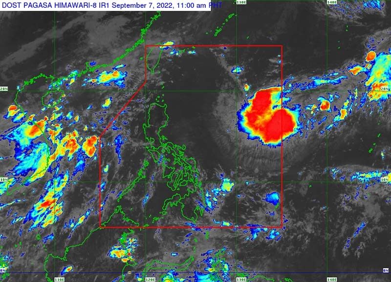
Cyclone forecast to enter PAR intensifies into tropical storm

MANILA, Philippines — A tropical cyclone forecast to enter the Philippine Area of Responsibility has intensified into a tropical storm ahead of its entry, state weather bureau PAGASA said Wednesday.
The tropical storm was last seen 1,445 kilometers east of Northern Luzon, with peak winds of 65 kph near the center and gusts of up to 80 kph.
Moving southwestward at 25 kph, the cyclone is forecast to enter PAR Wednesday afternoon or evening. Once it does, it will be called “Inday.”
“Based on the current forecast scenario, this tropical cyclone is unlikely to directly bring heavy rainfall and severe winds in the country,” PAGASA said.
“However, it may bring moderate to rough seas over the seaboards of Extreme Northern Luzon during the weekend,” it added, noting such conditions can pose risks to those using small seacrafts.
Weather specialist Grace Castañeda earlier said the cyclone is not expected to hit land.
However, it is likely to intensify into a severe tropical storm in the next 24 hours. Further intensification may occur as the cyclone moves over the Philippine Sea.
The weather agency also noted that the cyclone may move northwestward by Wednesday evening or early Thursday morning.
Position
8 p.m., September 7: 1,375 km east of Northern Luzon
8 a.m., September 8: 1,255 km east of Northern Luzon
8 p.m., September 8: 1,125 km east of Northern Luzon
8 a.m., September 9: 1,035 km east of Extreme Northern Luzon
8 p.m., September 9: 850 km east of Extreme Northern Luzon
8 a.m., September 10: 715 km east Northeast of Itbayat, Batanes
8 a.m., September 11: 520 km east Northeast of Itbayat, Batanes
8 a.m., September 12: 515 km northeast of Itbayat, Batanes
— Gaea Katreena Cabico
- Latest
- Trending


