Tropical depression seen to enter PAR Wednesday night
MANILA, Philippines — The tropical depression outside the Philippine Area of Responsibility is expected to enter the country’s jurisdiction on Wednesday evening or Thursday morning, the state weather bureau said.
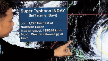
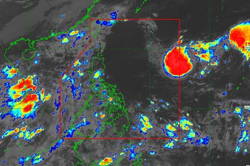
The tropical depression was last seen 1,525 kilometers east of Extreme Northern Luzon or 1,550 km east of Northern Luzon, PAGASA said in a bulletin issued at 5 a.m.
The cyclone was packing peak winds of 55 kph near the center and gusts of up to 70 kph.
Moving southward at 20 kph, the tropical depression is forecast to enter PAR Wednesday evening or Thursday morning. Once it does, it will be called “Inday.”
“Based on the current forecast scenario, this tropical cyclone is unlikely to directly bring heavy rainfall and severe winds in the country,” PAGASA said.
“However, it may [cause] moderate to rough seas over the seaboards of Extreme Northern Luzon during the weekend,” it added, noting such conditions can pose risks to those using small seacrafts.
According to weather specialist Grace Castañeda, the cyclone is not expected to hit land.
However, the tropical depression may reach tropical storm category within 36 hours. A “steady period of intensification” may occur as it moves over the Philippine Sea, PAGASA said.
The agency added that the cyclone may move northwestward by Thursday. — Gaea Katreena Cabico


- Latest
- Trending