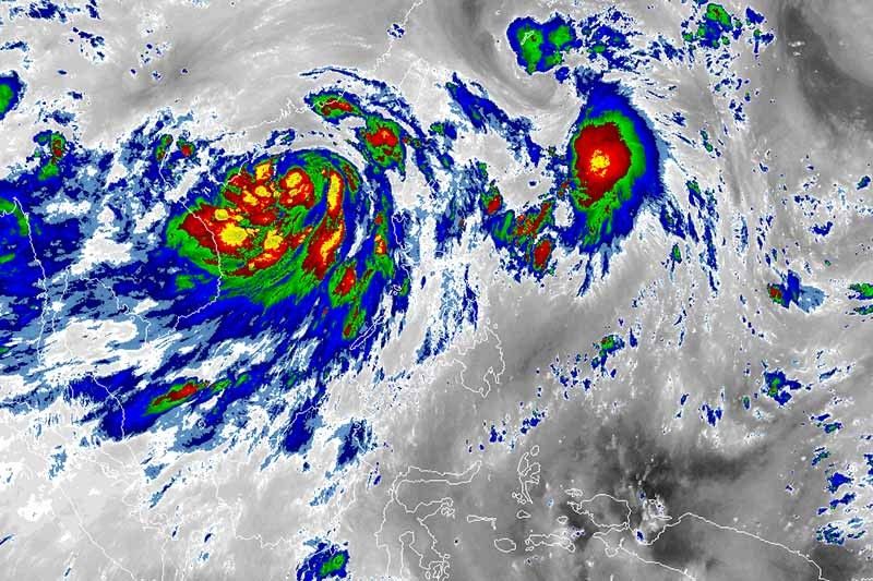
'Domeng' keeps strength, enhances southwest monsoon

MANILA, Philippines — Tropical Depression Domeng and a severe tropical storm outside the Philippine Area of Responsibility are enhancing the southwest monsoon or habagat, state weather bureau PAGASA said Friday morning.
Domeng was last spotted 950 kilometers east of Basco, Batanes. It is heading north at 20 km per hour.
The tropical depression kept its strength with peak winds of 55 kph near the center and gusts of up to 70 kph.
No tropical cyclone wind signal is currently hoisted for this tropical cyclone.
What to expect
- The southwest monsoon enhanced by Domeng and Severe Tropical Storm Chaba (formerly known as Caloy) will dump monsoon rains over the western sections of Central and Southern Luzon.
- Residents of Extreme Northern Luzon, the northern and western portions of Luzon, and the western portion of Visayas will experience occasionally gusty conditions reaching strong breeze to near gale in strength due to the enhanced southwest monsoon. PAGASA said these conditions are more likely in coastal and mountainous or upland localities of these areas.
- Due to Domeng, Chaba, and the prevailing southwest monsoon, a gale warning remains in effect over the western seaboards of Luzon.
- Moderate to rough seas (2.1 to 4 meters) are expected over the remaining seaboards of Northern Luzon. Such conditions may be risky for those using small seacrafts.
- The tropical depression may leave the Philippine Area of Responsibility on Saturday morning or afternoon.
- It is forecast to reach tropical storm category in the next 12 hours.
Forecast position
- Friday afternoon: 910 km east of Basco, Batanes
- Saturday morning 715 km east northeast of Itbayat, Batanes
- Saturday afternoon: 865 km northeast of Itbayat, Batanes (outside PAR)
- Sunday morning: 915 km north northeast of Itbayat, Batanes (outside PAR)
- Sunday afternoon: 1,075 km north northeast of Itbayat, Batanes (outside PAR)
— Gaea Katreena Cabico
- Latest
- Trending


