'Aghon' now over Samar Sea, Signal No. 1 raised over 17 areas
MANILA, Philippines — State weather bureau PAGASA on Saturday morning placed a total of 17 areas in Luzon and Visayas under Signal Number 1 due to Tropical Depression Aghon.
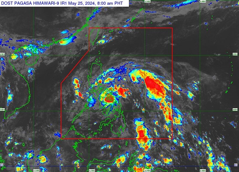
Aghon was last seen over the coastal waters of Calbayog City, Samar, with peak winds of 55 kilometers per hour near the center and gusts of up to 85 kph. It was heading northwestward at 30 kph.
PAGASA raised Signal No. 1 over the following areas:
Luzon
- Aurora
- Polillo Islands
- northern and southeastern portion of Quezon (Calauag, Guinayangan, Lopez, Buenavista, Catanauan, Mulanay, San Narciso, San Francisco, San Andres, Tagkawayan, Gumaca, Quezon, Alabat, Perez, Plaridel, Pitogo, Macalelon, General Luna, Atimonan, Unisan, Mauban, Real, Infanta, General Nakar, Padre Burgos, Agdangan);
- eastern portion of Romblon (Cajidiocan, Magdiwang, San Fernando, Romblon)
- eastern portion of Marinduque (Santa Cruz, Torrijos);
- Camarines Norte
- Camarines Sur
- Catanduanes
- Albay
- Sorsogon
- Masbate including Burias and Ticao Islands
Visayas
- Northern Samar
- Samar
- Eastern Samar
- Biliran
- northern portion of Leyte (Tunga, Pastrana, San Miguel, Matag-Ob, Tolosa, Palo, Calubian, Leyte, Mayorga, Julita, Carigara, Babatngon, Dagami, Jaro, San Isidro, Santa Fe, Albuera, Villaba, La Paz, Palompon, Tabontabon, Tanauan, Merida, Ormoc City, Isabel, Dulag, Capoocan, Alangalang, Burauen, Tabango, Tacloban City, Kananga, Barugo)
- extreme northern portion of Cebu (San Remigio, Tabogon, City of Bogo, Medellin, Daanbantayan, Borbon) including Camotes and Bantayan Islands
Minimal to minor impacts from strong winds are possible within any of the areas under Winds Signal No. 1.
Heavy rainfall outlook
Aghon is expected to bring significant rainfall and potential hazards to various regions in the country.
Saturday
- 100-200 mm: Bicol Region, Northern Samar, northern portion of Samar
- 50-100 mm: Southern Quezon, Polillo Islands, Marinduque, eastern Romblon, rest of Samar, Eastern Samar, Biliran, northern portions of Western Visayas, Leyte, and Cebu
Sunday
- 100-200 mm: Camarines Norte, Camarines Sur, Catanduanes
- 50-100 mm: Quezon, Aurora, rest of Bicol Region
"Forecast rainfall are generally higher in elevated or mountainous areas," PAGASA said.
"Under these conditions, flooding and rain-induced landslides are possible especially in areas that are highly or very highly susceptible to these hazards as identified in hazard maps and in localities that experienced considerable amounts of rainfall for the past several days," it added.
Hazards affecting coastal waters
PAGASA said that Aghon will bring moderate to rough seas (1.5 to 3.5 meters) over the coastal waters along the seaboards of Bicol Region, southern Quezon, eastern Eastern Visayas, western Samar and Northern Samar, and eastern Caraga Region on Saturday.
It also advised mariners operating motor bancas and similarly-sized vessels to take precautionary measures and avoid navigating these waters if possible, especially if inexperienced or operating ill-equipped vessels.
Track and intensity outlook
According to PAGASA, Aghon will move generally northwestward over the Samar Sea and cross the Bicol Peninsula between Saturday afternoon and early Sunday morning.
It is expected to emerge over Lamon Bay or the waters north of the Camarines Provinces by early Sunday morning.
Another landfall is possible in the vicinity of the Polillo Islands on Sunday morning. During this period, Aghon may reach tropical storm category.
It may exit the Philippine Area of Responsibility (PAR) no earlier than Tuesday.
Forecast position
- May 25, 2024 5:00 p.m.: Over the coastal waters of Pasacao, Camarines Sur
- May 26, 2024 5:00 a.m.: Over the coastal waters of Capalonga, Camarines Norte
- May 26, 2024 5:00 p.m.: 65 km east southeast of Baler, Aurora
- May 27, 2024 5:00 a.m.: Over the coastal waters of Dinapigue, Aurora
- May 27, 2024 5:00 p.m.: 165 km east of Tuguegarao City, Cagayan
- May 28, 2024 5:00 a.m.: 320 km east of Calayan, Cagayan
- May 29, 2024 5:00 a.m.: 960 km east Northeast of Extreme Northern Luzon
- May 30, 2024 5:00 a.m.: 2,020 km northeast of extreme northern Luzon (outside PAR)


- Latest
- Trending