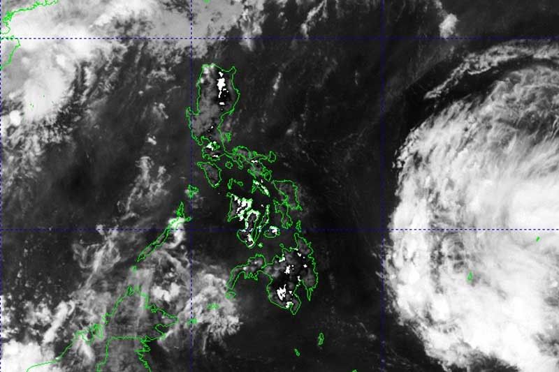
Possible 1st cyclone for 2024: PAGASA monitors LPA east of Mindanao

MANILA, Philippines — The Philippine Atmospheric, Geophysical, and Astronomical Services Administration (PAGASA) said on Wednesday it is monitoring a low pressure area (LPA) east of Mindanao that may develop into the country’s first cyclone of the year.
The cloud cluster east of southeastern Mindanao developed into an LPA this morning, according to PAGASA.
The weather disturbance may enter the Philippine Area of Responsibility (PAR) tonight or Thursday morning.
It may affect and make landfall over the Bicol region-Eastern Visayas area by late Friday or on Saturday, still as an LPA. Then, it may emerge over the waters east of Luzon.
The weather bureau said that the development of LPA into a tropical depression around Sunday or Monday is “not ruled out, but less likely.”
If the LPA becomes a tropical depression, it will be named Aghon, making it the country’s first cyclone of 2024.
Another scenario shows the LPA recurving over the Philippine Sea near the Bicol Region or Eastern Visayas, potentially developing into a tropical depression by Friday or Saturday.
The Philippines may experience generally fair weather conditions with higher chances of thunderstorms, especially in the afternoon and evening, until Thursday.
By Friday, the LPA may bring scattered rain showers and thunderstorms in Bicol region and Eastern Visayas.
The through of the LPA, which may also develop into tropical depression, may dump scattered rain showers over the eastern portion of Southern Luzon and Eastern Visayas, which may trigger flash floods and landslides.
PAGASA previously said the country may see up to two tropical cyclones this month as hot weather continues to affect the country.
- Latest
- Trending


