Pinoys warned: Watch out for Neneng
MANILA, Philippines — President Marcos advised the public to be on alert for Tropical Depression Neneng as it approaches Northern Luzon, as he gave assurance that necessary preparations have been put in place to avoid severe impact and casualties.
During a media interview yesterday in Pasay City, Marcos underscored the need to watch out for the incoming storm, which looks a little stronger.
“Neneng now, I think, unfortunately, looks a little stronger. It looks a little stronger than the previous one and its track is more to the north,” Marcos said. “I think the key to all of these is to watch it very closely because the storms now have a new feature. They develop quickly so we must be very vigilant. So that’s what we are doing.”
He recalled Typhoon Karding last month, which quickly intensified as it approached the country, leaving at least 12 people dead and billions of pesos in damage.
The President also assured the public that the government has a disaster response template pegged on the Philippine Atmospheric, Geophysical and Astronomical Services Administration (PAGASA)’s weather forecast.
In terms of relief goods, materials and assets, Marcos said concerned agencies had put these as close as possible to areas in Neneng’s track.
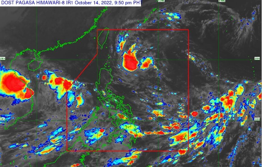
Neneng may intensify
Neneng could further intensify into a tropical storm before it passes by or makes landfall in Babuyan Islands or Batanes tomorrow, according to PAGASA.
Neneng was monitored 795 kilometers east of Calayan, Cagayan at 3 p.m. yesterday, carrying maximum sustained winds of 55 kph near the center and gustiness of up to 70 kph. Moderate to heavy with at times intense rains are expected over Batanes, Cagayan including Babuyan Islands, Apayao, Abra, Kalinga, Ilocos Norte and Ilocos Sur.
By tomorrow, Neneng will bring light to moderate with at times heavy rains over Isabela and the rest of Ilocos region and Cordillera Administrative Region (CAR).
The weather bureau also warned of possible flooding and rain-induced landslides during at times heavy rains as Tropical Cyclone Wind Signal No. 1 was hoisted over Batanes, Cagayan including Babuyan Islands, eastern portion of Apayao, and northern Isabela.
Neneng’s trough could also bring scattered rainshowers over Bicol region, Mimaropa, Western Visayas, Zamboanga peninsula, Samar provinces, Biliran, Basilan, Sulu and Tawi-Tawi. Meanwhile, Metro Manila and the rest of the country will see isolated rainshowers due to the trough and localized thunderstorms. – Helen Flores, Ralph Edwin Villanueva


- Latest
- Trending