


Signal No. 3 lifted as ‘Karding’ continues to move away
MANILA, Philippines — Tropical Cyclone Wind Signal No. 3 has been lifted as Typhoon Karding (Noru) continued to move away from the Luzon landmass, PAGASA said Monday morning.
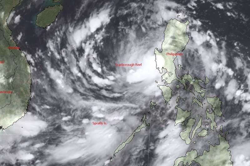
Karding was last seen 190 kilometers west of Dagupan City in Pangasinan, with peak winds of 140 kph near the center and gusts of up to 170 kph. It was heading west northwest at 30 kph.
PAGASA raised wind signals over the following areas:
TCWS No. 2 (Winds of greater than 62 kph and up to 88 kph may be expected in at least 24 hours)
- Western section of Pangasinan (Bolinao, Bani, City of Alaminos, Anda, Sual, Labrador, Mabini, Agno, Burgos, Dasol, Infanta, Bugallon, Lingayen, Aguilar)
- Northern portion of Zambales (Santa Cruz, Candelaria, Masinloc, Palauig, Iba)
TCWS No. 1 (Winds of 39-61 kph may be expected in at least 36 hours or intermittent rains may be expected within 36 hours)
- La Union
- Rest of Pangasinan
- Southern portion of Benguet (Sablan, La Trinidad, Itogon, Baguio City, Tuba, Kapangan, Tublay)
- Rest of Zambales
- Northern portion of Bataan (Bagac, City of Balanga, Abucay, Samal, Morong, Orani, Hermosa, Dinalupihan)
- Tarlac
- Pampanga
- Western portion of Nueva Ecija (Cabiao, San Isidro, Jaen, San Antonio, Lupao, Science City of Muñoz, Santo Domingo, Talavera, Aliaga, Zaragoza, Cuyapo, Talugtug, Nampicuan, Guimba, Licab, Quezon)
What to expect
Weather forecasters said that moderate to heavy with at times intense rains are expected over Zambales, Bataan, and Lubang Islands until Monday noon.
Meanwhile, light to moderate with at times heavy rains will affect the western portion of Pangasinan.
PAGASA added that occasional to monsoon rains are still possible in the next 24 hours over the western sections of Central Luzon, Southern Luzon, and Visayas, especially as the rainbands of Karding moved further away from the landmass.
Gale-force conditions remain possible within any of the areas where Signal No. 2 is hoisted, while strong winds (strong breeze to near gale strength) may still be experienced within any of the areas where Signal No. 1 is currently in effect.
The enhanced southwest monsoon may also bring moderate to rough seas (1.5 to 3 meters) over the western seaboards of Southern Luzon, Visayas, and Mindanao, PAGASA added. These conditions may be risky for those using small seacrafts.
Karding is forecast to track generally westward over the West Philippine Sea toward Vietnam. It will exit the Philippine Area of Responsibility tonight.
Karding, the strongest cyclone to hit the Philippines this year, made landfalls in Burdeos in Quezon province and Dingalan in Aurora before sweeping Central Luzon.
Flights were cancelled and classes were suspended as heavy rains and strong winds toppled trees and power lines, and damaged crops in the heavily agricultural Central Luzon.
Karding’s position
- September 26, 5 p.m.: 390 km west of Dagupan City, Pangasinan
- September 27, 5 a.m.: 690 km west of Dagupan City, Pangasinan (outside PAR)
- September 27, 5 a.m.: 930 km west southwest of Northern Luzon (outside PAR)


- Latest
- Trending


