Signal No. 1 up over several areas as 'Maring' merges with remnants of LPA 'Nando'
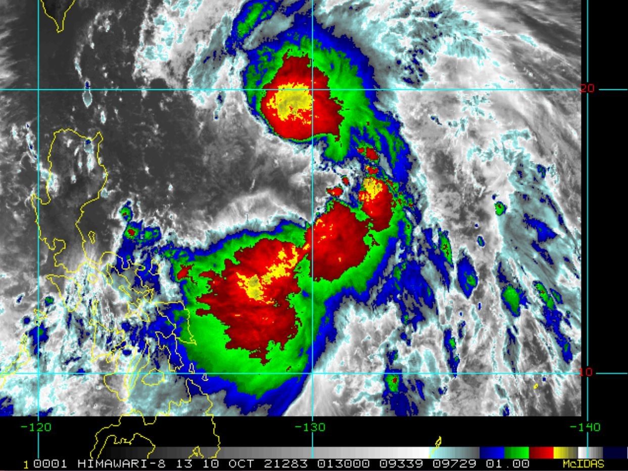
MANILA, Philippines — Tropical Storm Maring (international name Kompasu) continues to merge with what's left of the now-low pressure area Nando, leaving several areas in the Philippines under Signal No. 1, government weather forecasters said.
Per PAGASA's latest weather bulletin Sunday morning, Maring was last seen 665 km East of Virac, Catanduanes moving northward at 10 kph.
The state weather bureau added that Maring is carrying Maximum sustained winds of 85 kph near the center and gustiness of up to 105 kph.
According to PAGASA, the assimilation of Maring and Nando "will likely be completed in the next 6 to 12 hours," but the merger cyclone is seen to intensify within the forecast period.
"The possibility of a landfall over mainland Luzon is not ruled out at this time," PAGASA said, adding that Maring is forecast to move over the Luzon strait Monday evening and Tuesday morning.

PAGASA warned that moderate to heavy rains due to Maring could be encountered in the next 24 hours over Eastern Samar and Catanduanes.
Meanwhile, light to moderate rains, heavy at times, may also be expected over the Bicol Region, Caraga and the rest of Visayas.
Strong winds are expected in areas under Tropical Cyclone Wind Signal No. 1, including:
- Catanduanes
- Batanes
- Cagayan including Babuyan Islands
- northeastern portion of Isabela (Santa Maria, Cabagan, Tumauini, San Pablo, Maconacon, Divilacan, Palanan, Ilagan City, San Mariano)
- Eastern Samar
- eastern portion of Northern Samar (San Roque, Pambujan, Las Navas, Catubig, Laoang, Mapanas, Lapinig, Gamay, Palapag, Mondragon, Silvino Lobos)
- eastern portion of Samar (Matuguinao, San Jose de Buan, Hinabangan, Paranas)
- Dinagat Islands
- Surigao del Norte
No other areas are on higher wind signals.
"Persons living in areas identified to be highly or very highly susceptible to these hazards are advised to follow evacuation and other instructions from local officials," PAGASA said.
PNP on alert for 'Maring'
The Philippine National Police said its commanders were directed to place units on standby in the event that search and rescue operations are needed in the wake of Maring.
Police Gen. Guillermo Eleazar, PNP chief, said he also tasked all concerned police units to prepare all the necessary assets for the possible evacuation of residents that will be affected or hit by the typhoon.
"We urge our countrymen to abide by the orders of your local government and not wait until your life is in danger until you will ask for help to be saved," Eleazar said in Filipino.
“I also gave instructions to the PNP regional directors put on standby enough forces that will help not only in preemptive evacuation but also on the conduct of search and rescue and other disaster response,” Eleazar said.
Eleazar said that local residents in storm surge, flood, and landslide-prone areas should heed the call of their respective local government units for their safety.
— Franco Luna


- Latest
- Trending