'Leon' strengthens into tropical storm, brings rains to parts of Philippines
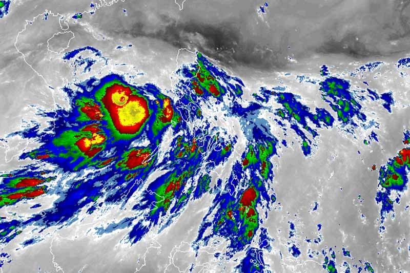
MANILA, Philippines — “Leon”—the 12th tropical cyclone for 2020—strengthened into a tropical storm as it moved over the West Philippine Sea, state weather forecasters said early Wednesday.
The tropical storm was given an international name “Noul”— a name contributed by North Korea, which means “red sky.”
“Leon” was last spotted 225 kilometers west northwest of Coron, Palawan bearing peak winds of 65 km per hour near the center and gusts of up to 80 kph. Moving west northwest at 10 kph, it is expected to leave the Philippine Area of Responsibility Thursday morning.
PAGASA said “Leon” is likely to continue intensifying. It is forecast to become a severe tropical storm category within 24 hours and a typhoon within 48 hours.
As the tropical storm continues to move away from land, there are no tropical cyclone wind signals currently in effect.
However, intermittent gusts may be experienced over Batanes, Babuyan Islands, Palawan (including Kalayaan, Calamian and Cuyo Islands), Mindoro provinces, Romblon and Western Visayas.
Residents of Aurora, Rizal, Palawan (including Kalayaan, Calamian and Cuyo Islands), Mindoro provinces, Romblon, Western Visayas and Negros Oriental will have moderate to heavy rains.
Meanwhile, light to moderate with at times heavy rains will affect Bicol region, Caraga, Northern Mindanao, Zamboanga Peninsula, Metro Manila, Isabela, Basilan, Sulu, Tawi-Tawi, and the rest of Central Luzon, Calabarzon, Mimaropa and Visayas.
PAGASA warned that flooding and rain-induced landslide may occur during heavy or prolonged rainfall, especially in areas that are highly or very highly susceptible to hazards.
The weather bureau also said that sea travel is risky over the western seaboard of Palawan (including Calamian and Kalayaan Islands) and Occidental Mindoro (including Lubang Island) due to rough to very rough seas.
Meanwhile, moderate to rough seas will prevail over the northern, eastern and southern seaboards of Luzon and the seaboards of Visayas and Mindanao. Fisherfolk and those with small sea vessels are advised to take precaution.
Forecast positions
- Thursday morning: 440 km north northeast of Kalayaan Islands
- Friday morning: 945 km west of Central Luzon (outside PAR)


- Latest
- Trending