'Ineng' slightly speeds up, may exit PAR on Saturday evening
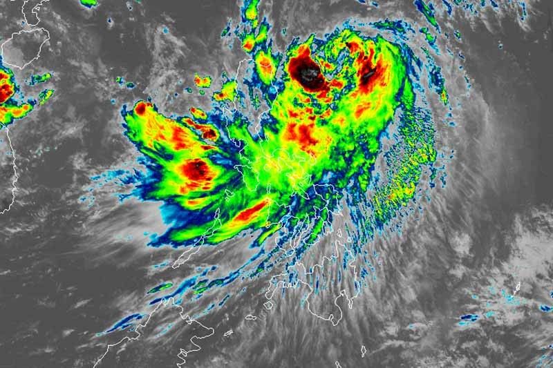
MANILA, Philippines — Severe Tropical Storm Ineng (Bailu) has slightly gained speed as it heads north northwest, state weather bureau PAGASA said in a bulletin issued late Friday morning.
“Ineng” is now moving at 25 kilometers per hour from the previous 20 kph. It was last spotted 500 km east northeast of Tuguegarao City, Cagayan or 510 km east of Calayan, Cagayan.
The severe tropical storm maintained its maximum sustained winds of 95 kph near the center and gusts of up to 115 kph.
It is seen to leave the Philippine area of responsibility on Saturday evening.
Tropical Wind Signal No. 2 remains hoisted over Batanes. Residents of the province may experience winds between 61 kph and 120 kph in at least 24 hours.
Weather forecasters said the “closest approach” of “Ineng” to Batanes is possible in the succeeding hours but it has a low chance of making a landfall.
Signal No. 1 is still raised over:
- Cagayan including Babuyan Group of Isalands
- Isabela
- Apayao
- Kalinga
- Northern Abra
- Ilocos Norte
Winds between 30 to 60 kph or intermittent rains may be expected in these areas in at least 24 hours.
Due to the weather disturbance, moderate to heavy rains will affect residents of Batanes, Cagayan (including Babuyan Group of Islands), Ilocos Norte and Apayao.
Light to moderate with intermittent heavy rains, meanwhile, will be experienced in Zambales, Bataan, Metro Manila, Cavite, Batangas, Mindoro Provinces, northern portions of Palawan (including Calamian and Cuyo Islands), Aklan, Antique, and the rest of Ilocos region, Cordillera Administrative Region and Cagayan.
By Saturday, moderate to heavy rains may prevail over Batanes and Babuyan Group of Islands.
Meanwhile, those living in Ilocos region, CAR, Cagayan, Zambales, Bataan, Metro Manila, Cavite, Batangas, Mindoro provinces and northern portions of Palawan (including Calamian and Cuyo Islands).
Travel by sea remains risky over the seaboards of areas under TCWS and the eastern seaboards of Central Luzon, Southern Luzon and Visayas.
Forecast positions
- Saturday morning: 140 km north of Basco, Batanes
- Sunday morning: 665 northwest of Basco, Batanes (outside PAR)
- Monday morning: 1,150 km northwest of Basco, Batanes (outside PAR)
— Gaea Katreena Cabico


- Latest
- Trending