Signal No. 4 up in Cagayan, northern Isabela as 'Ompong' draws closer to land
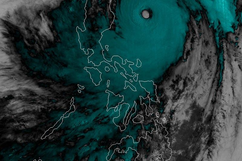
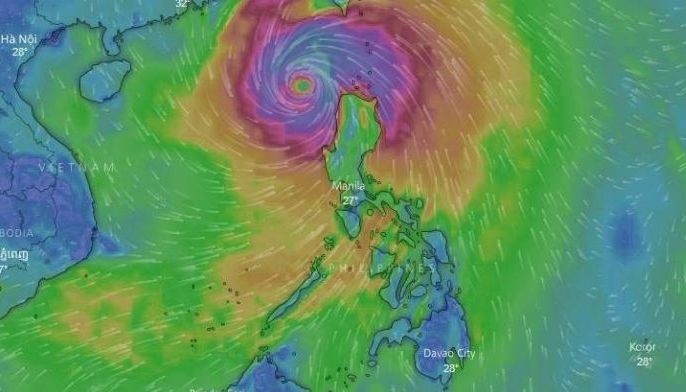
MANILA, Philippines — State weather bureau PAGASA has placed Cagayan and northern Isabela under Signal No. 4 Friday afternoon as Typhoon “Ompong” moves closer to the Philippine landmass.
Very strong winds ranging from 171 to 220 kilometers per hour are expected in at least 12 hours over these areas.
PAGASA said that residents in areas under Signal No. 4 may experience "torrential rains, very strong winds and possible storm surge."
“Ompong” was last seen east northeast of Casiguran, Aurora with maximum winds of up to 205 kilometers per hour and gustiness of up to 255 kilometers per hour.
The typhoon slightly accelerated from moving 25 kilometers per hour to 30 kilometers per hour northwest.
Tropical cyclone warning signals have been also raised in the following areas:
Signal No. 3 (Winds of 121 to 170 kilometers per hour in at least 18 hours)
- Babuyan Group of Islands
- Ilocos Norte
- Ilocos Sur
- Apayao
- Abra
- Kalinga
- Mt. Province
- Bengue
- Ifugao
- Nueva Vizcaya
- Quirino
- Northern Aurora
- Southern Isabela
Signal No. 2 (Winds of 61 to 120 kilometers per hour in at least 24 hours)
- Batanes
- La Union
- Pangasinan
- Tarlac
- Nueva Ecija
- Southern Aurora
- Northern Zambales
Signal No. 1 (Winds of 30 to 60 kilometers per hour in at least 36 hours)
- Southern Zambales
- Pampanga
- Bulacan
- Bataan
- Rizal
- Metro Manila
- Cavite
- Batangas
- Laguna
- Quezon, including Polillo Islands
- Northern Occidental Mindoro, including Lubang Island
- Northern Oriental Mindoro
- Masbate
- Marinduque
- Camarines Norte
Stormy weather is expected over areas under Signal Nos. 2 and 4. Those under Signal No. 1 will experience occasional rains and gusty winds.
“Ompong” is forecast to hit the Cagayan-Isabela landmass early Saturday morning.
Weather officials said that the typhoon—the strongest to hit the country this year—will bring intense winds, which will leave considerable damage to structure and will uproot trees and down electric posts.
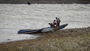
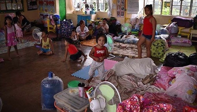
PAGASA urged those living in the path of “Ompong," especially residents vulnerable to storm surge, should consider evacuating.
Forecast positions
- Saturday afternoon: 150 kilometers west northwest of Laoag City, Ilocos Norte (after landfall in Cagayan)
- Sunday afternoon: 775 kilometers west northwest of Laoag City, Ilocos Norte (Outside PAR)
- Monday morning: 1,435 kilometers west northwest of Laoag City, Ilocos Norte (Outside PAR)


- Latest
- Trending