Signal No. 4 in extreme northern Luzon likely due to ‘Goring’ — PAGASA
MANILA, Philippines (Update 1, 12:16 p.m.) — State weather bureau PAGASA said Tuesday morning that it may hoist Signal No. 4 over extreme northern Luzon as the cyclone continued to head to the Luzon Strait.
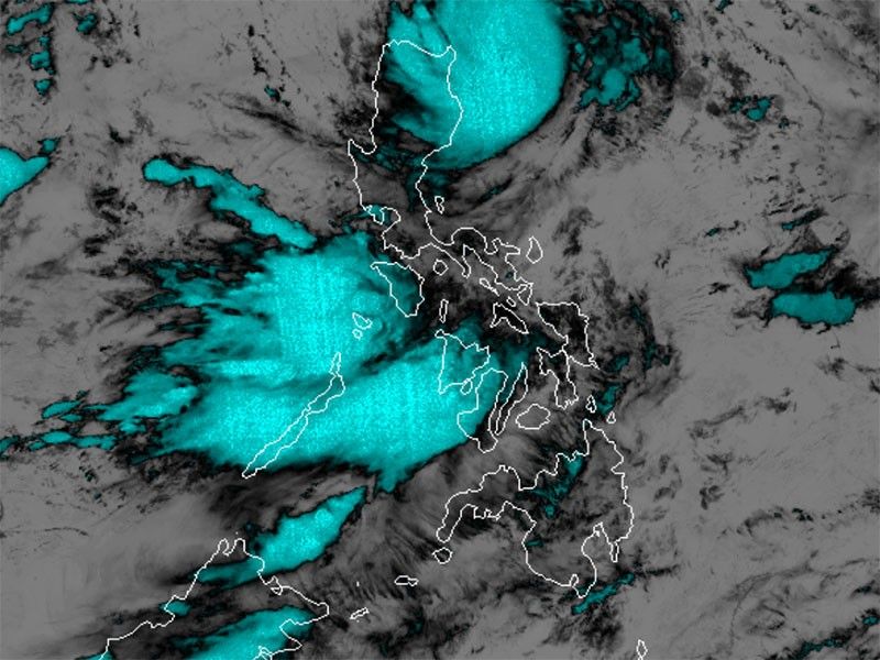
The typhoon was last seen 180 kilometers to the east of Aparri in Cagayan, with maximum peak winds of 155 kilometers per hour near the center and gusts of up to 190 kph, PAGASA said in its 11 a.m. bulletin. It was moving northwest slowly.
PAGASA said Goring may persist in strength by the time it passes very close or over Batanes Wednesday morning or afternoon. Re-intensifying into a super typhoon is not ruled out.
Wind signals were raised in parts of Northern Luzon due to the typhoon.
Signal No. 3
- Southern portion of Batanes (Sabtang, Uyugan, Ivana, Mahatao, Basco)
- Northeastern portion of Babuyan Islands (Babuyan Is.)
Storm-force winds may result in moderate to significant impacts in the area.
Signal No. 2
- Rest of Batanes
- Rest of Babuyan Islands
- Extreme northeastern portion of mainland Cagayan (Santa Ana, Gonzaga)
Gale-force winds could potentially cause minor to moderate impacts in these areas.
Signal No. 1
- Northern and eastern portions of mainland Cagayan (Camalaniugan, Pamplona, Santa Teresita, Baggao, Buguey, Claveria, Aparri, Ballesteros, Abulug, Sanchez-Mira, Santa Praxedes, Allacapan, Lal-Lo, Lasam, Peñablanca, Iguig, Amulung, Gattaran, Alcala, Santo Niño)
- Eastern portion of Isabela (Dinapigue, San Mariano, Ilagan City, Tumauini, San Pablo, Cabagan, Maconacon, Divilacan, Palanan)
- Northern portion of Apayao (Flora, Calanasan, Luna, Pudtol, Santa Marcela)
- Northern portion of Ilocos Norte (Vintar, Pasuquin, Burgos, Dumalneg, Adams, Pagudpud, Bangui)
Areas under Signal No. 1 may experience possible minimal to minor impacts from strong winds.
What to expect
Between 100 and 200 millimeters or around four to eight inches of rain is forecast to fall along the northeastern portion of Babuyan Islands on Tuesday.
Residents of Batanes, the rest of Babuyan Islands, Ilocos Norte, the northern portion of Abra, the northern portion of Apayao, and the northern and eastern portions of mainland Cagayan may have 50 to 100 mm of accumulated rainfall.
PAGASA warned that floods and landslides may occur in areas that are highly vulnerable to these hazards, and in places that received substantial amounts of rainfall in the past few days.
The southwest monsoon enhanced by Goring will continue to bring occasional or monsoon rains over the western portions of Central Luzon, Southern Luzon, and Visayas over the next three days.
The enhanced southwest monsoon will also bring gusty conditions over the following areas that are not under any wind signal: Aurora, Bataan, Bulacan, Metro Manila, Calabarzon, Mimaropa, Bicol region, Visayas, Dinagat Islands, Camiguin and most of Zamboanga Peninsula.
Potential Hanna
The tropical storm called Haikui may enter PAR Wednesday morning. Once inside the country’s area of responsibility, it will be called Hanna.
The cyclone is expected to become a typhoon within the PAR region.
“The current forecast scenario suggests that Haikui is less likely to directly affect the country. However, it may enhance the Southwest Monsoon beginning on Wednesday or Thursday,” PAGASA said in its 11 a.m. bulletin, noting this will result in the continuation of occasional or monsoon rains over the western portion of Luzon and Visayas throughout the week.
The tropical storm was last seen 1,660 km east of extreme Northern Luzon, with peak winds of 75 kph and gusts of up to 90 kph.
Goring’s forecast position
- August 29, 2023 8:00 PM - 140 km east of Calayan, Cagayan
- August 30, 2023 8:00 AM - Over the coastal waters of Sabtang, Batanes
- August 31, 2023 8:00 PM - 140 km west of Itbayat, Batanes
- August 31, 2023 8:00 AM - 305 km west northwest of Itbayat, Batanes (outside PAR)
- August 31, 2023 8:00 PM - 415 km west northwest of Itbayat, Batanes (outside PAR)
- September 1, 2023 8:00 AM - 520 km west northwest of Itbayat, Batanes (outside PAR)
- September 2, 2023 8:00 AM - 700 km west northwest of Itbayat, Batanes (outside PAR)
- September 3, 2023 8:00 AM - 855 km west northwest of Northern Luzon (outside PAR)
— Gaea Katreena Cabico


- Latest
- Trending