


'Paeng' seen to exit Luzon landmass in 6 to 12 hours
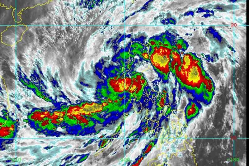
MANILA, Philippines — Severe Tropical Storm Paeng (international name: Nalgae) will likely exit the Luzon landmass in six to 12 hours as it leaves the Laguna de Bay and the Metro Manila-Rizal-Bulacan area as of 11:00 p.m. on Saturday, state weather bureau PAGASA said.
In its latest bulletin, PAGASA said Paeng was last seen in the vicinity of Baliwag, Bulacan as of 10:00 p.m. It packed maximum sustained winds of 95 kph near the center and gustiness of up to 160 kph.
Paeng is moving north northwestward heading to West Philippine Sea, at 15 kph.
LIVE UPDATES: Severe Tropical Storm Paeng
The storm is forecast to exit the Philippine Area of Responsibility on Monday, PAGASA added.
“PAENG may maintain its strength from the remainder of its traverse of the Luzon landmass, although the possibility of slight weakening is not ruled out within the next 6 hours”, state meteorologists said.
They also warned that Paeng will likely undergo further re-intensification as it moves over the West Philippine Sea.
READ: NDRRMC recommends national state of calamity due to ‘Paeng’
What to expect
PAGASA said Metro Manila, Zambales, Bataan, Tarlac, Pampanga, Bulacan, Rizal, Laguna, Cavite, Batangas, and the northern portion of mainland Quezon may experience heavy to intense with at times torrential rains through tomorrow morning:
Mainland Cagayan Valley, Cordillera Administrative Region, Mindoro Provinces, the central portion of Quezon including Polillo Islands, and the rest of Central Luzon meanwhile is forecast to have moderate to heavy with at times intense rains likely
“Light to moderate with at times heavy rains possible over Ilocos Region, Bicol Region, Western Visayas, and the rest of MIMAROPA and Quezon,” it added.
On Sunday, Metro Manila, mainland Cagayan Valley, Cordillera Administrative Region, Central Luzon, Rizal, Laguna, Cavite, Batangas, Mindoro Provinces, and the northern portion of mainland Quezon to experience moderate to heavy with at times intense rains.
“Light to moderate with at times heavy rains possible over Ilocos Region, Bicol Region, Western Visayas, and the rest of MIMAROPA, and Quezon including Polillo Islands,” the state weather bureau said.
“Under these conditions, widespread flooding and rain-induced landslides are expected, especially in areas that are highly or very highly susceptible to these hazard as identified in hazard maps and in localities with significant antecedent rainfall,” it added.
PAGASA also warned that the outer circulation of Paeng and the surge of northeast monsoon will bring gusty condition reaching strong to gale-force strength over the rest of Luzon and Western Visayas, likely in coastal and upland/mountainous areas.
TCWS No. 3 (storm-force winds)
Luzon
- The northern portion of Metro Manila (City of Manila, City of Valenzuela, City of Malabon, City of Navotas, Caloocan City, Quezon City)
- Bataan
- the southern portion of Zambales (San Marcelino, Subic, Olongapo City, Castillejos, San Antonio, San Narciso, San Felipe, Cabangan, Botolan, Palauig, Iba)
- Pampanga
- Bulacan
- the southern portion of Tarlac (Concepcion, Capas, San Jose, Bamban)
TCWS No. 2 (gale-force winds)
Luzon
- Pangasinan
- the southern portion of Aurora (San Luis, Baler, Dingalan, Maria Aurora)
- the rest of Tarlac
- Nueva Ecija
- the rest of Zambales
- Laguna
- Batangas
- the northern and central portions of Quezon (Alabat, Perez, Plaridel, Atimonan, Unisan, Agdangan, Padre Burgos, Pagbilao, Sariaya, Lucena City, San Antonio, Tiaong, Candelaria, Dolores, City of Tayabas, Lucban, Sampaloc, Mauban, General Nakar, Infanta, Real) including Pollilo Islands
- Rizal
- Cavite
- the rest of Metro Manila
- the northern portion of Oriental Mindoro (Victoria, Naujan, San Teodoro, Baco, Puerto Galera, City of Calapan)
- the northern portion of Occidental Mindoro (Santa Cruz, Abra de Ilog, Mamburao, Paluan) including Lubang Islands
TCWS No. 1 (strong winds)
Luzon
- La Union
- Kalinga
- Abra
- Benguet
- Ifugao
- Ilocos Sur
- Mountain Province
- Nueva Vizcaya
- Quirino
- Isabela
- the rest of Aurora
- the rest of Quezon
- Catanduanes
- Camarines Sur
- Camarines Norte
- Albay
- Sorsogon
- the western portion of Masbate (Milagros, Mobo, Uson, City of Masbate, Aroroy, Balud, Mandaon, Baleno) including Burias and Ticao Islands
- the rest of Occidental Mindoro
- the rest of Oriental Mindoro
- Palawan (El Nido, Taytay) including Calamian Islands
- Cuyo Islands
- Romblon
- Marinduque
Visayas
- Capiz
- Aklan
- the northern portion of Antique (Barbaza, Culasi, Tibiao, Sebaste, Libertad, Bugasong, Laua-An, Pandan) including Caluya Islands
Paeng’s forecast position
- Oct 30, 2022 08:00 AM - 160 km West of Iba, Zambales
- Oct 30, 2022 08:00 PM - 270 km West Northwest of Iba, Zambales
- Oct 31, 2022 08:00 AM - 365 km West of Dagupan City, Pangasinan
- Oct 31, 2022 08:00 PM - 390 km West of Sinait, Ilocos Sur (Outside PAR)
- Nov 1, 2022 08:00 AM - 405 km West of Laoag City, Ilocos Norte (Outside the PAR)
- Nov 1, 2022 08:00 PM - 510 km West of Calayan, Cagayan (Outside the PAR)
- Nov 2, 2022 08:00 PM - 670 km West of Basco, Batanes (Outside the PAR)
- Nov 3, 2022 08:00 PM - 870 km West of Extreme Northern Luzon (Outside the PAR)


- Latest
- Trending


