Pagasa: 'Nyatoh' to intensify but no longer expected to enter PAR
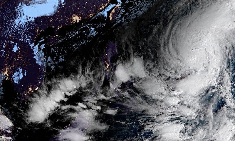
MANILA, Philippines — Tropical cyclone Nyatoh has intensified into a typhoon, and though no longer expected to enter the Philippine area of responsibility, its trough is projected to bring rainfall in some parts of the Philippines, state weather bureau Pagasa said Thursday.
According to the state weather forecast, Nyatoh (international name) was last spotted 1,440 kilometers east of Central Luzon arond 3 a.m. packing maximum sustained winds of 130 kph near the center and is moving northward at 10 kph.
"Despite its distance from the Philippine landmass, the trough of this typhoon will bring increased likelihood of scattered light to moderate with at times heavy rains and thunderstorms over Bicol Region, Visayas, and Mindanao in the next 24 hours," Pagasa said.
"The typhoon is forecast to move generally northeastward beginning tonight until Saturday," it also said, adding that Nyatoh is "no longer expected to enter the Philippine area of responsibility."
Meanwhile, the northeast monsoon will cause light rains over Batanes, Cagayan, Isabela, Quirino, Apayao, and Aurora. It will also cause isolated light rains over the rest of Luzon.
The rest of the country will have isolated rain showers due to localized thunderstorms.
Moderate to strong winds and moderate to rough seas will prevail over Luzon and the Visayas.

— Franco Luna


- Latest
- Trending