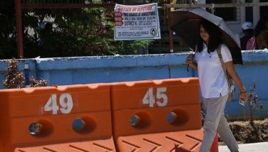
Signal No. 3 lifted as 'Jolina' weakens into severe tropical storm
MANILA, Philippines — PAGASA has lifted Signal No. 3 in parts of the country as it said Typhoon "Jolina" (Conson) weakened into a severe tropical storm on Tuesday afternoon.
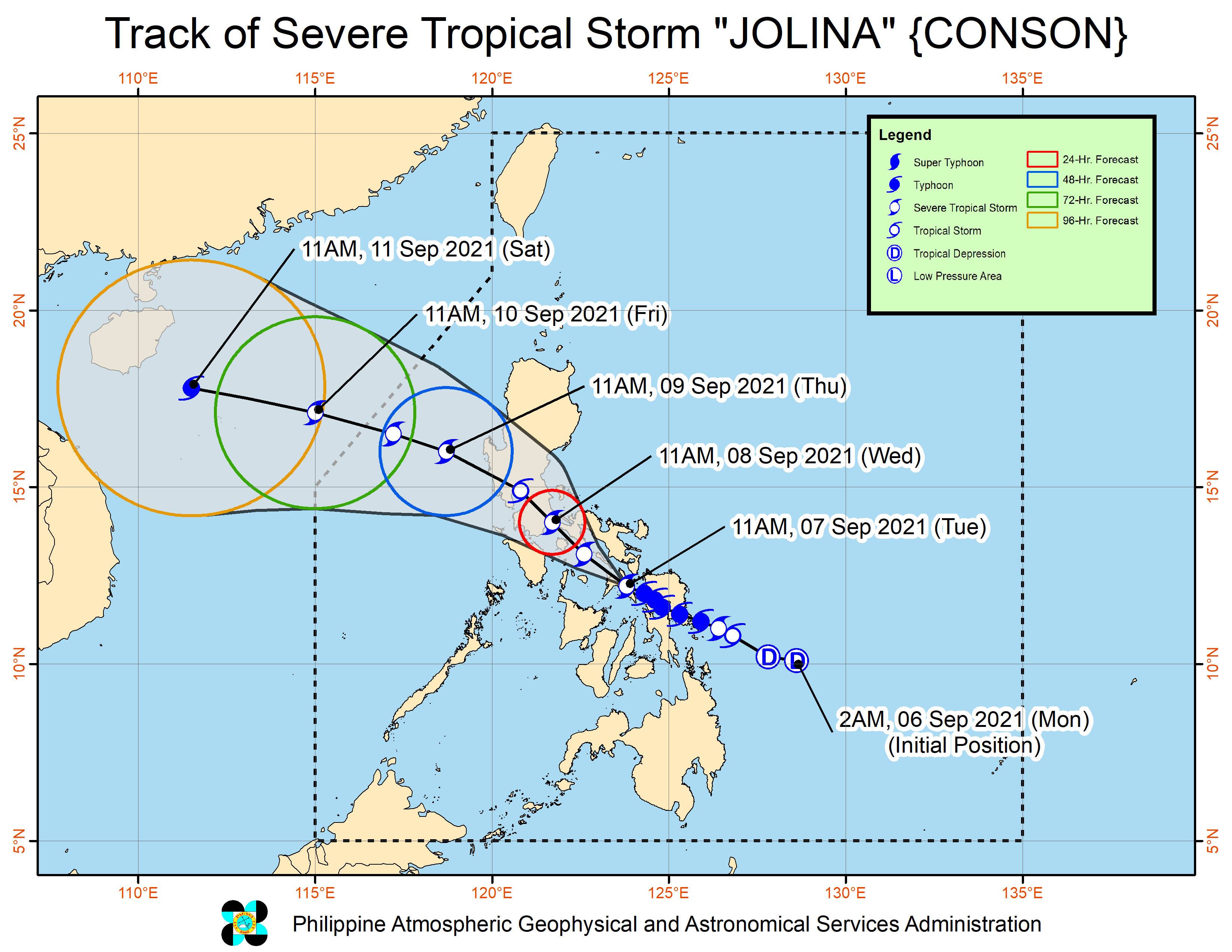
The weather bureau said Jolina was last seen in the vicinity of Baleno in Masbate at 1 p.m.
It now packs 110 kilometers per hour maximum sustained winds, and gustiness of up to 135 kph.
Jolina kept its direction at west northwestward as well as its speed at 15 kph.
It made landfall five times before it weakened, the last over Dimasalang in Masbate. But PAGASA said it could still make another landfall in southeastern Quezon tonight or early Wednesday morning.
Tropical Cyclone Wind Signals remain in effect over these areas as of 2 p.m.:
TCWS No. 2
(Damaging gale-force to storm-force winds prevailing or expected within 24 hours)
- Masbate including Ticao and Burias Islands
- northern portion of Romblon (San Fernando, Cajidiocan, Magdiwang, Romblon, Corcuera, Banton, Concepcion, Calatrava, San Agustin, San Andres)
- Sorsogon
- Albay (Polangui, Oas, City of Ligao, Guinobatan, Camalig,
- Daraga, Legazpi City, Manito, Jovellar, Pio Duran, Libon)
- western and southern portions of Camarines Sur (Bato, Nabua, Balatan, Iriga City, Baao, Bula, Ocampo, Pili, Naga City, Canaman, Pamplona, Milaor, Gainza, Camaligan, San Fernando, Minalabac, Pasacao, Libmanan, Magarao, Cabusao, Bombon, Sipocot, Lupi, Ragay, Del Gallego)
- western portion of Camarines Norte (Paracale, Jose Panganiban, Capalonga, Santa Elena, Labo, San Vicente, San Lorenzo Ruiz), central and southern portions of Quezon (Tagkawayan, Guinayangan, Lopez, Buenavista, San Narciso, San Andres, San Francisco, Mulanay, Catanauan, General Luna, Macalelon, Calauag, Gumaca, Pitogo, Unisan, Atimonan, Plaridel, Agdangan, Padre Burgos, Quezon, Alabat, Perez, Mauban, City of Tayabas, Sampaloc, Lucban, Pagbilao, Lucena City, Sariaya, Candelaria, Dolores,Tiaong, San Antonio, Real)
- Laguna
- southeastern portion of Batangas (Santo Tomas, Malvar, Balete, Mataasnakahoy, Lipa City, Padre Garcia, Rosario, San Juan, Lobo, Taysan, Ibaan, Batangas City, San Jose, Cuenca)
- Marinduque
- western portion of Northern Samar (Lope de Vega, Catarman, Bobon, Victoria, San Jose, Rosario, Lavezares, Biri, Allen, San Isidro, San Antonio, Capul, San Vicente, Mondragon)
- extreme northwestern portion of Samar (Calbayog City, Santo Niño, Almagro, Tagapul-An)
- northern portion of Biliran (Maripipi, Kawayan, Almeria)
TCWS. No 1
(Strong winds prevailing or expected within 36 hours)
- rest of Camarines Norte
- rest of Camarines Sur
- rest of Albay
- Catanduanes
- rest of Romblon
- Oriental Mindoro
- Occidental Mindoro
- rest of Quezon
- Rizal
- rest of Batangas
- Cavite
- Metro Manila
- Bulacan
- Bataan
- Nueva Ecija
- Tarlac,
- Zambales
- Pampanga
- southern portion of Aurora (Dipaculao, Maria Aurora, Baler, San Luis, Dingalan)
- southern portion of Quirino (Nagtipunan)
- southeastern portion of Nueva Vizcaya (Dupax del Norte, Dupax del Sur, Alfonso Castaneda, Aritao, Santa Fe)
- southern portion of Pangasinan (San Nicolas, Natividad, San Quintin, Umingan, Balungao, Santa Maria, Asingan, San Manuel, Tayug, Sison, San Fabian, Pozorrubio, Laoac, Binalonan, City of Urdaneta, Rosales, Villasis, Santo Tomas, Alcala, Bautista, Bayambang, Malasiqui, Manaoag, San Jacinto, Mapandan, Santa Barbara, Mangaldan, Dagupan City, Calasiao, San Carlos City, Binmaley, Basista, Urbiztondo, Mangatarem, Aguilar, Lingayen, Bugallon, Infanta, Labrador, Sual, Mabini, Dasol)
- rest of northern Samar
- northern and central portions of Samar (Matuguinao, San Jose de Buan, Gandara, Santa Margarita,
- Paranas, San Jorge, Tarangnan, Pagsanghan, Motiong, Jiabong, City of Catbalogan, Hinabangan, San Sebastian, Calbiga, Pinabacdao, Villareal, Talalora, Santa Rita, Daram, Zumarraga)
- northern of Eastern Samar (Jipapad, Arteche, Maslog, Dolores, Oras, San Policarpo), the rest of Biliran, the
- northern portion of Leyte (Calubian, San Isidro, Leyte, Tabango, Villaba, Matag-Ob, Kananga, Capoocan, Carigara, Jaro, Alangalang, San Miguel, Babatngon, Tacloban City, Santa Fe, Palompon, Isabel, Merida, Ormoc City, Dagami, Tabontabon, Tanauan,
- Pastrana, Barugo, Tunga, Palo, Tolosa, Burauen, Albuera)
- northern portion of Cebu (Daanbantayan, Medellin, Santa Fe, Bantayan Islands, City of Bogo, San Remigio, Tabogon, Borbon, Tabuelan, Sogod, Tuburan, Catmon, Carmen, Danao City, Asturias, Compostela, Camotes Islands, Liloan, Consolacion, Cebu City,Balamban, Mandaue City)
- northern portion Negros Occidental (Cadiz City, Manapla, Enrique B. Magalona, City of Victorias, Sagay City, City of Escalante, Toboso, Calatrava, Silay City)
- northern portion of Iloilo (Carles, Estancia, Balasan, Batad, San Dionisio, Concepcion, Sara, Ajuy, Lemery, San Rafael, Barotac Viejo, City of Passi, Bingawan)
- Capiz
- Aklan
What to expect
These areas will see heavy to intense with at times torrential rains in the next 24 hours, according to PAGASA:
- Masbate
- Leyte
- Biliran
- Samar
- Northern Samar
- Sorsogon
- Albay
- Catanduanes provinces
- Southern Quezon
- Romblon
- Marinduque
The Mindoro provinces and the rest of Calabarzon and Visayas will also experience moderate to heavy with at times intense rains.
PAGASA warned scattered to widespread flooding including flashfloods and landslides are possible especially in areas highly to very highly susceptible to the said hazards.
The threat of coastal inundation due to storm surge of up to 0.5 to 1.0 meter also remains for several coastal localities of Biliran, Sorsogon, Samar and Masbate.
Jolina is forecast to cross Central Luzon and roughly to the east and north of Metro Manila by tomorrow and until Thursday morning.
It is expected to emerge over the West Philippine Sea before Thursday noon, the weather bureau added.
Forecast Position
- Wednesday noon: In the vicinity of Pagbilao, Quezon
- Thursday noon: 175 km west of Dagupan City, Pangasinan
- Friday noon: 600 km west of Baguio City, Benguet (Outside PAR)
— Christian Deiparine


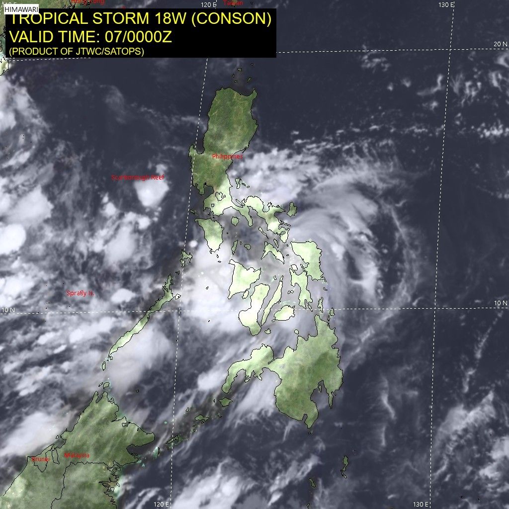
Follow this page for updates on Jolina, the tenth tropical cyclone to enter the Philippines on 2021. — Main photo from JTWC
Typhoon Kiko slightly weakens as it moves towards the Babuyan Islands-Batanes area, state weather bureau PAGASA says on Friday morning.
At 4 a.m., Kiko was located 280 km east northeast of Casiguran, Aurora with winds of 185 kph and gustiness of 230 kph.
Tropical cyclone wind signals are raised in the following areas:
Signal No. 3
- the extreme northeastern portion of Cagayan (Santa Ana)
Signal No. 2
- Batanes
- Babuyan Islands
- the remaining eastern portion of mainland Cagayan (Aparri, Camalaniugan, Lal-Lo, Gattaran, Baggao, Peñablanca, Buguey, Santa Teresita, Gonzaga)
- the northeastern portion of Isabela (San Pablo, Maconacon, Divilacan, Palanan)
Signal No. 1
- the rest of mainland Cagayan
- the northeastern portion of Ilocos Norte (Pagudpud, Adams, Dumalneg, Bangui, Vintar, Carasi)
- Apayao
- the eastern portion of Kalinga (City of Tabuk, Pinukpuk, Rizal)
- the northwestern and southeastern portions of Isabela (Santa Maria, Quezon, Mallig, Roxas, San Manuel, Cabatuan, Aurora, City of Cauayan, Angadanan, San Guillermo, Dinapigue, San Mariano, Cabagan, Santo Tomas, Delfin Albano, Tumauini, Quirino, Burgos, Gamu, Ilagan City, Luna, Reina Mercedes, Naguilian, Benito Soliven)
- the northern portion of Aurora (Dilasag, Casiguran)
All tropical cyclone wind signals have been lifted as Tropical Storm Jolina continues to move over the West Philippine Sea, state weather bureau PAGASA says.
The tropical cyclone is forecast to exit the Philippine Area of Responsibility Thursday night.
At 10 a.m., Jolina was located 240 km west of Dagupan City, Pangasinan with winds of 85 kph and gustiness of 115 kph. It is moving west ward at 10 kph.
Severe Tropical Storm Jolina is forecast to exit the Philippine Area of Responsibility by Thursday afternoon or evening, state weather bureau PAGASA says.
At 4 a.m., Jolina was located 145 km west northwest of Iba, Zambales or 175 km west of Dagupan City, Pangasinan with winds of 85 kph and gustiness of 5 kph.
Tropical cyclone wind signal no. 1 is hoisted over:
- the western portion of Pangasinan (Anda, Bolinao, Infanta, Aguilar, Sual, Labrador, Dasol, Bugallon, Burgos, Mabini, Agno, City of Alaminos, Bani, Lingayen, Mangatarem)
- the northern portion of Zambales (San Antonio, Botolan, San Narciso, San Felipe, Cabangan, Palauig, Iba, Masinloc, Candelaria, Santa Cruz)
Severe Tropical Storm Jolina continues to move northwestward crossing the Batangas-Cavite area before emerging over the mouth of Manila Bay on Wednesday afternoon or evening.
State weather bureau PAGASA says Jolina is expected to make its ninth landfall in the vicinity of Bataan Peninsula tonight.
At 2 p.m., Jolina was located in the vicinity of San Nicolas, Batangas with winds of 95 kph and gustiness of 160 kph. It is moving northwestward at 15 kph.
Tropical cyclone wind signals are up in the following areas:
Signal No. 2
- the northern and central portions of Oriental Mindoro (Bansud, Gloria, Pinamalayan, Pola, Socorro, Victoria, Puerto Galera, San Teodoro, Baco, City of Calapan, Naujan)
- the northern and central portions of Occidental Mindoro (Abra de Ilog, Paluan, Mamburao, Santa Cruz, Sablayan) including Lubang Islands
- the central portion of Quezon (Infanta, Real, Mauban, Sampaloc, Lucban, City of Tayabas, Lucena City, Sariaya, Candelaria, Dolores, Tiaong, San Antonio, Pagbilao)
- Batangas
- Cavite
- Laguna
- Rizal
- Metro Manila
- the southern portion of Bulacan (Pandi, Bulacan, Marilao, Calumpit, Norzagaray, Plaridel, Santa Maria, Balagtas, Bocaue, Bustos, City of Malolos, Angat, Obando, City of San Jose del Monte, Pulilan, City of Meycauayan, Hagonoy, Paombong, Guiguinto, San Rafael, Baliuag)
- Pampanga
- Bataan
- Zambales
- Tarlac
Signal No. 1
- Marinduque
- La Union
- the southern portion of Benguet (Sablan, Tublay, Bokod, La Trinidad, Baguio City, Itogon, Tuba, Kapangan, Atok)
- the southern portion of Nueva Vizcaya (Alfonso Castaneda, Dupax del Norte, Dupax del Sur, Aritao, Santa Fe, Kayapa)
- the southern portion of Aurora (Baler, Maria Aurora, San Luis, Dingalan)
- Pangasinan
- Nueva Ecija
- the rest of Bulaca
- the northern and southern portions of Quezon (Padre Burgos, Agdangan, Unisan, Gumaca, Atimonan, Plaridel, Pitogo, Macalelon, Quezon, Alabat, Perez, General Nakar) including Polillo Islands
- the rest of Oriental Mindoro
- the rest of Occidental Mindoro


- Latest
- Trending