


'Fabian' maintains strength, forecast to exit PAR by Thursday
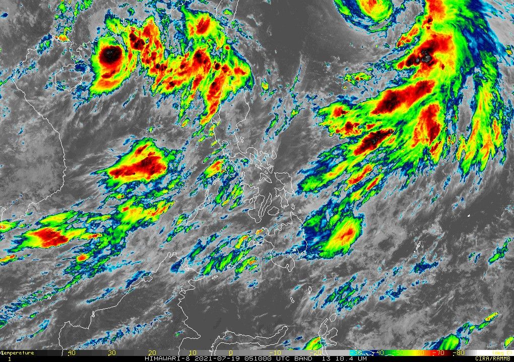
MANILA, Philippines (Updated 6:30 p.m.) — Severe Tropical Storm "Fabian" (In-fa) kept its strength as it remains almost stationary, PAGASA said on Monday afternoon.
The agency in its 5 p.m. bulletin said Fabian was last seen at 1,075 kilometers east northeast of extreme northern Luzon.
It maintained its 95 kilometers per hour peak winds, and gusts of up to 115 kph.
PAGASA said there is still no storm signal raised in any part of the country, with the sixth storm to enter the Philippines this year remaining unlikely to bring heavy rainfall.
While such is the forecast, monsoon rains would still be experienced in the next 24 hours over Ilocos Region, Zambales, Bataan, Occidental Mindoro, and Palawan.
This is due to the southwest monsoon enhanced by Fabian and the tropical storm outside the country at west northwest of extreme northern Luzon.
"However, residents and disaster managers in Batanes and Babuyan Islands are advised to continuously m onitor the tropical cyclone bulletins," PAGASA said, "as any further southward shift in the orientation of the forecast may result in the hoisting of Signal No. 1 over these areas."
Still due to the influence of the southwest monsoon, the western seaboard of Palawan including Kalayaan Islands will experience moderate to rough seas in the next 24 hours.
The weather bureau advised small seacrafts to take precautionary measures when going out in the sea, and advised inexperienced mariners to avoid navigating under the conditions.
PAGASA said Fabian will begin to move generally west northwestward in the next 12 hours.
It could now exit the Philippine Area of Responsibility by afternoon or evening on Thursday.
This was a change from the earlier forecast of sometime between Tuesday or Wednesday which forecasters attributed to a southward shift in the orientation of its track.
Forecast Position
- Tuesday afternoon: 900 km east northeast of extreme northern Luzon
- Wednesday afternoon: 770 km northeast of Itbayat, Batanes (Outside PAR)
- Thursday afternoon: 590 km north northeast of Itbayat, Batanes (Outside PAR)
— Christian Deiparine
Follow this page for updates on Fabian, the sixth tropical cyclone to enter the Philippine Area of Responsibility this year. — Main photo from JMA
Typhoon Fabian continues to move slowly over the Philippine Sea southeast of Yaeyama Islands, PAGASA says.
At 4 p.m., Fabian was located 505 km northeast of Itbayat, Batanes with winds of 150 kph and gustiness of up to 185 kph. It is moving westward slowly.
The tropical cyclone is unlikley to bring heavy rainfall in the country but it will enhance the Southwest Monsoon, which will bring rains over Ilocos Region, Abra, Benguet, Zambales, Bataan, Tarlac, Pampanga, Bulacan, Metro Manila, Calabarzon, Occidental Mindoro, Oriental Mindoro Marinduque, Romblon and the northern portion of Palawan including Calamian and Kalayaan Islands.
Severe Tropical Storm Fabian remains almost stationary while maintaining its strength, state weather bureau PAGASA says Monday afternoon.
At 4 p.m., the tropical cyclone was located 1,075 km east northeast of extreme northern Luzon with winds of 95 kph and gustiness of 115 kph.'
PAGASA says Fabian is unlikely to bring heavy rainfall in the country but it will influence the southwest monsoon bringing rains over Ilocos Region, Zambales, Bataan, Occidental Mindoro and Palawan.
"Fabian" intensifies into a severe tropical storm as it moves northwestward, state weather bureau PAGASA says.
At 10 a.m., Fabian was located 1,055 km east northeast of extreme northern Luzon with winds of 95 kph and gusts of 115 kph.
PAGASA says the weather disturbance may exit Philippine Area of Responsibility Tuesday evening or Wednesday early morning.
TROPICAL CYCLONE BULLETIN NO. 12
— PAGASA-DOST (@dost_pagasa) July 19, 2021
Severe Tropical Storm “#FabianPH” (IN-FA)
Issued at 11:00 AM, 19 July 2021
Valid for broadcast until the nextt bulletin at 5:00 PM today
“FABIAN” INTENSIFIES INTO A SEVERE TROPICAL STORM.
Link: https://t.co/nOU97294Wi pic.twitter.com/kp7KS3uCJP
Tropical Storm Fabian slightly intensifies as it moves over the Philippine Sea, state weather bureau PAGASA says.
At 4 p.m., Fabian was located 1,095 km east northeast of extreme northern Luzon, packing winds of 75 kph and gusts of 90 kph. It is moving north northwestward at 10 kph.
PAGASA says the weather disturbance will remain far from Philippine landmass throughout the forecast period.
TROPICAL CYCLONE BULLETIN NO. 9
— PAGASA-DOST (@dost_pagasa) July 18, 2021
Tropical Storm “#FabianPH” (IN-FA)
Issued at 5:00 PM, 18 July 2021
Valid for broadcast until the next bulletin at 11:00 PM today
“FABIAN” SLIGHTLY INTENSIFIES WHILE MOVING NORTH NORTHWESWARD OVER THE PHILIPPINE SEA. pic.twitter.com/8bxFhrapeW
Tropical Storm Fabian moves slowly over the Philippine Sea while maintaining it strength, state weather bureau PAGASA says.
At 10 a.m., Fabian was located 1,100 km east northeast of extreme northern Luzon with winds of 65 kph and gustiness of up to 80 kph. It is moving north northwestward slowly.
PAGASA says Fabian is expected to further intensify into a severe tropical storm by Monday afternoon. It will likely reach typhoon category by Tuesday night.


- Latest
- Trending


