Tropical Storm Fabian keeps strength as it approaches Philippine Sea
MANILA, Philippines (Updated 12:02 p.m.) — Weather bureau PAGASA on Sunday said Tropical Storm "Fabian" has kept its strength as it slowly moves toward the Philippine Sea.
The agency in its forecast said Fabian was last seen at 1,100 kilometers east northeast of extreme northern Luzon.
It remains with maximum sustained winds of 65 kilometers per hour, and gustiness of up to 80 kph.
The sixth storm to enter the country this year moves north northwestward at a speed of 10 kph.
It is expected to keep that direction at a consistent speed, and make its way out of the Philippine Area of Responsibility by Monday evening.
PAGASA said there is still no storm signal in any part of the country.
Fabian is also unlikely to bring heavy rainfall throughout its forecast period, the agency added.
The tropical storm, along with a low pressure area at 630 km west of Calayan in Cagayan, are enhancing the southwest monsoon.
"Further intensification is expected for the remainder of the forecast period," PAGASA said, "with Fabian reaching severe tropical storm category by Monday afternoon."
Forecast Position
- Monday morning: 1,050 km east northeast of Extreme Northern Luzon
- Tuesday morning: 945 northeast of Extreme Northern Luzon
- Wednesday morning: 785 km northeast of Itbayat, Batanes

— Christian Deiparine
Follow this page for updates on Fabian, the sixth tropical cyclone to enter the Philippine Area of Responsibility this year. — Main photo from JMA
Typhoon Fabian continues to move slowly over the Philippine Sea southeast of Yaeyama Islands, PAGASA says.
At 4 p.m., Fabian was located 505 km northeast of Itbayat, Batanes with winds of 150 kph and gustiness of up to 185 kph. It is moving westward slowly.
The tropical cyclone is unlikley to bring heavy rainfall in the country but it will enhance the Southwest Monsoon, which will bring rains over Ilocos Region, Abra, Benguet, Zambales, Bataan, Tarlac, Pampanga, Bulacan, Metro Manila, Calabarzon, Occidental Mindoro, Oriental Mindoro Marinduque, Romblon and the northern portion of Palawan including Calamian and Kalayaan Islands.
Severe Tropical Storm Fabian remains almost stationary while maintaining its strength, state weather bureau PAGASA says Monday afternoon.
At 4 p.m., the tropical cyclone was located 1,075 km east northeast of extreme northern Luzon with winds of 95 kph and gustiness of 115 kph.'
PAGASA says Fabian is unlikely to bring heavy rainfall in the country but it will influence the southwest monsoon bringing rains over Ilocos Region, Zambales, Bataan, Occidental Mindoro and Palawan.
"Fabian" intensifies into a severe tropical storm as it moves northwestward, state weather bureau PAGASA says.
At 10 a.m., Fabian was located 1,055 km east northeast of extreme northern Luzon with winds of 95 kph and gusts of 115 kph.
PAGASA says the weather disturbance may exit Philippine Area of Responsibility Tuesday evening or Wednesday early morning.
TROPICAL CYCLONE BULLETIN NO. 12
— PAGASA-DOST (@dost_pagasa) July 19, 2021
Severe Tropical Storm “#FabianPH” (IN-FA)
Issued at 11:00 AM, 19 July 2021
Valid for broadcast until the nextt bulletin at 5:00 PM today
“FABIAN” INTENSIFIES INTO A SEVERE TROPICAL STORM.
Link: https://t.co/nOU97294Wi pic.twitter.com/kp7KS3uCJP
Tropical Storm Fabian slightly intensifies as it moves over the Philippine Sea, state weather bureau PAGASA says.
At 4 p.m., Fabian was located 1,095 km east northeast of extreme northern Luzon, packing winds of 75 kph and gusts of 90 kph. It is moving north northwestward at 10 kph.
PAGASA says the weather disturbance will remain far from Philippine landmass throughout the forecast period.
TROPICAL CYCLONE BULLETIN NO. 9
— PAGASA-DOST (@dost_pagasa) July 18, 2021
Tropical Storm “#FabianPH” (IN-FA)
Issued at 5:00 PM, 18 July 2021
Valid for broadcast until the next bulletin at 11:00 PM today
“FABIAN” SLIGHTLY INTENSIFIES WHILE MOVING NORTH NORTHWESWARD OVER THE PHILIPPINE SEA. pic.twitter.com/8bxFhrapeW
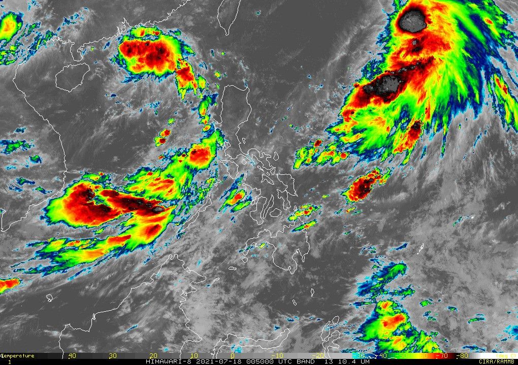
Tropical Storm Fabian moves slowly over the Philippine Sea while maintaining it strength, state weather bureau PAGASA says.
At 10 a.m., Fabian was located 1,100 km east northeast of extreme northern Luzon with winds of 65 kph and gustiness of up to 80 kph. It is moving north northwestward slowly.
PAGASA says Fabian is expected to further intensify into a severe tropical storm by Monday afternoon. It will likely reach typhoon category by Tuesday night.


- Latest
- Trending