Batanes only province under Signal No. 1 due to ‘Sarah’
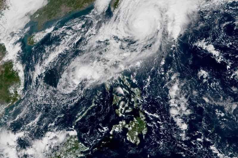
MANILA, Philippines — Tropical Cyclone Wind Signal No. 1 over Babuyan Islands has been lifted due to changes in the forecast track of Severe Tropical Storm Sarah (international name: Fung-wong).
Only Batanes is placed under TCWS No. 1, PAGASA said in its latest bulletin. Residents of the province will experience winds between 30 and 60 kilometers per hour in at least 36 hours.
The center of “Sarah” was located 275 km east of Basco, Batanes. It now packs maximum sustained winds of 100 kph from the previous 95 kph and gusts of up to 125 kph from the previous 115 kph.
The severe tropical storm is moving west-northwest at 10 kph.
Weather forecasters expect “Sarah” to “gradually weaken” on Friday or Saturday. It is also seen to leave the Philippine area of responsibility on Saturday.
The trough or extension of “Sarah” will bring light to moderate rains with some isolated heavy rains over Isabela, Cagayan, Aurora and northern Quezon. These were also affected by “Ramon”—the 18th tropical cyclone this year.
Gusty conditions will also prevail over the northern and western sections of northern Luzon, especially in the coastal and mountainous areas due to the surge of the northeast monsoon or amihan.
PAGASA warned against sea travel over the seaboards of areas under TCWS, seaboards of northern and central Luzon, seaboard of southern Luzon.
LPA west of Zambales
Meanwhile, the remnant low pressure area of “Ramon” was seen 225 km west southwest of Subic, Zambales.
The LPA is affecting the western seaboard of central and southern Luzon.
It is not expected to re-intensify into a tropical cyclone.
Forecast positions of “Ramon”
- Friday morning: 255 km northeast of Basco, Batanes
- Saturday morning: 555 km north northeast of Basco, Batanes (outside PAR)
- Sunday morning: 1,175 north northeast of Basco, Batanes (outside PAR)
— Gaea Katreena Cabico


- Latest
- Trending