


Manila has NCR’s most flood-prone streets – MMDA
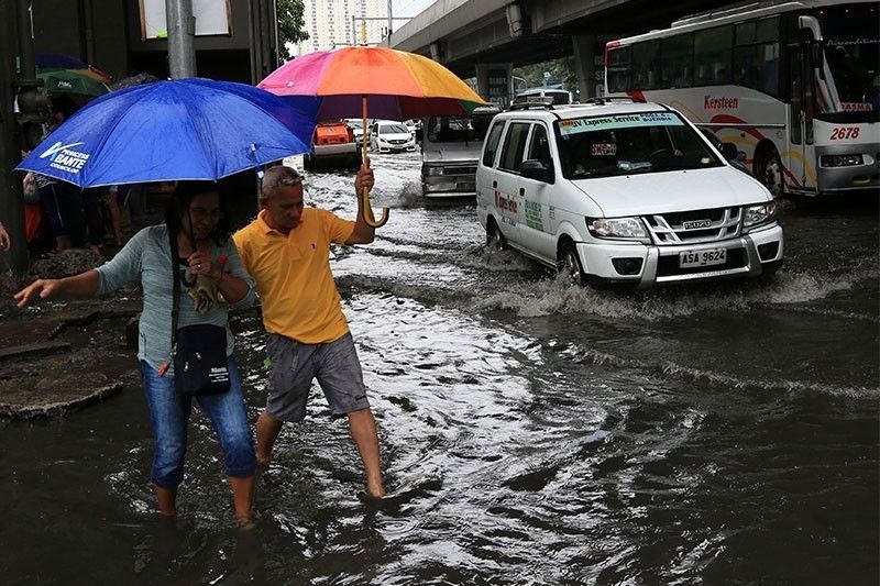
MANILA, Philippines — The city of Manila has the highest number of flood-prone streets among the National Capital Region (NCR)’s 16 cities and one town, according to a study by the Metropolitan Manila Development Authority (MMDA).
The MMDA’s flood control and sewerage management office reported that Manila has the highest number of flood-prone streets at 16 after an hour’s worth or 80 millimeters (mm) of rain.
In the same report, the agency also said that not only is Metro Manila prone to floods due to rising seas, these 16 streets are among 51 areas –including highways, streets, and avenues – that are also likely to be inundated by a flood that will last for an hour and more if dumped with an hour’s worth of continuous rain.
Inadequate drainage capacity was the cause of the flooding at the corner of Quirino Avenue and Pedro Gil (30 centimeters flood depth), Dapitan street/ Basilio to Casanas street (50 cm), Maceda street/ Maria Clara to Makiling streets (50 cm), Ramon Magsaysay/Ampil street to Magsaysay Flyover (80 cm), España Lacson street to Blumentritt (90 cm), Taft Avenue from UN to Vito Cruz (20 cm), Roxas Boulevard-Raja Sulayman (30 cm), V. Mapa from Guadalcanal to Old Sta. Mesa street (60 cm) and Quirino Avenue eastbound from Angel Linao to Estero de Paco (30 cm).
The presence of informal settlers along estuaries was the cause of flooding at A. Mendoza street/Remigio to Bambang streets (50 cm), Laon Laan street/ Lacson Avenue to A. Mendoza street (40 cm), Dimasalang street/Lacson to VG Cruz (50 cm), Abad Santos Tayuman (40 cm), and Abad Santos Yuseco (40 cm).
MMDA flood control chief Baltazar Melgar said with this study, the agency was able to detect the areas that needed the operation of the city’s 64 pumping stations, although most of them are no longer 100 percent efficient.
There are 14 large pumping stations in the city of Manila.
Quezon City has the second highest number of flood-prone areas at six after 80 mm of rainwater, followed by Makati City with five and Pasay with four.
In Quezon City, inadequate drainage capacity is the cause of flood on EDSA-Quezon Avenue corner Centris, Quezon Avenue near Biak na Bato, Tandang Sora corner Congressional Avenue and CP Garcia Katipunan corner UP Diliman.
Melgar said he hoped the $500-million Metro Manila Flood Management Plan will be done before 2050, when much of Metro Manila is likely to be submerged in flood due to rising seas according to a study by New Jersey-based science organization Climate Central that was published in the journal Nature Communications.
The flood management plan, to be funded by the Philippine government, World Bank and the Asian Infrastructure Investment Bank, seeks to repair 36 pumping stations, construct 20 new ones, and build waterway infrastructure to address flooding in Manila, Pasay, Taguig, Makati, Malabon, Mandaluyong, San Juan, Pasig, Valenzuela, Quezon City and Caloocan.


- Latest
- Trending


