PAGASA: Up to 3 tropical cyclones seen in August
MANILA, Philippines — Up to three tropical cyclones may enter or form within the Philippine area of responsibility (PAR) this August, according to the Philippine Atmospheric, Geophysical and Astronomical Services Administration (PAGASA).
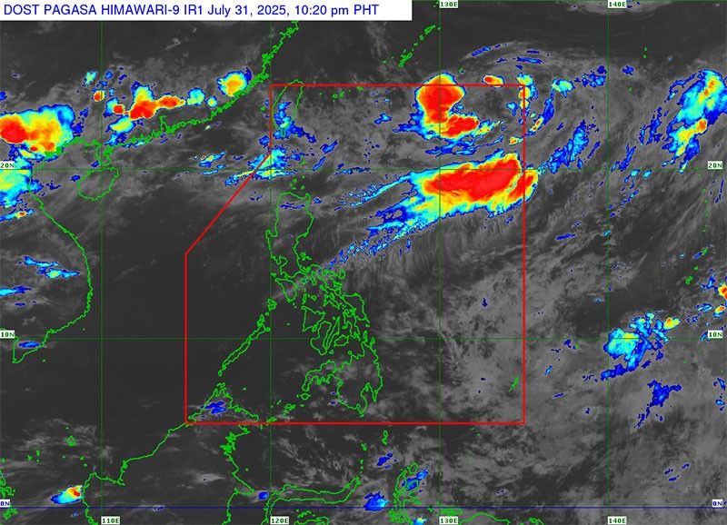
As of 2 p.m. yesterday, a low-pressure area (LPA) located 955 kilometers east-northeast of extreme Northern Luzon was being closely monitored by the weather bureau.
The system, which was first spotted on Thursday morning, has a high chance of developing into a tropical cyclone within 24 hours. While it is not expected to directly affect the country, PAGASA said it may briefly enter the PAR before moving out. Should it intensify into a tropical storm, it will be named “Fabian.”
PAGASA added that cloud clusters east of Mindanao are also being observed for potential development into a cyclone. Historically, two to three storms form or enter the PAR in August. If further cyclones develop, they will be named “Gorio” and “Huaning.”
State meteorologists outlined four possible cyclone paths common during this month.
Two scenarios suggest a northwestward movement from the northern Visayas or Central Luzon toward Northern Luzon, which could lead to landfall.
In other cases, storms may veer toward Taiwan, Southern China, or Japan’s Ryukyu Islands, avoiding direct impact on the Philippines.
Meanwhile, the southwest monsoon or habagat continues to bring scattered rains and thunderstorms across Central and Northern Luzon.
PAGASA forecasts that the monsoon will gradually weaken in the coming days, improving weather conditions, particularly over the weekend.
In the next 24 hours, residents in the Ilocos Region, Batanes, Babuyan Islands, Apayao, Abra, Benguet, Zambales, Bataan, Nueva Ecija, Tarlac and Pampanga can expect cloudy skies with scattered rain and thunderstorms.


- Latest
- Trending