PAGASA: LPA to bring rains over Northern Luzon, may become tropical cyclone
MANILA, Philippines — The low pressure area inside the Philippine Area of Responsibility will bring rains to parts of Luzon and may develop into a tropical depression, the state weather bureau reported Monday.
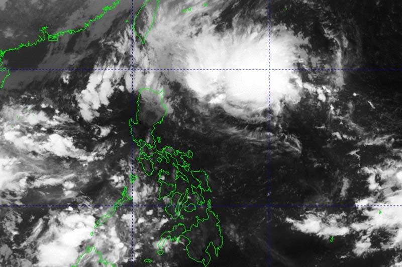
According to an advisory issued past 7 a.m., the weather disturbance was last seen 450 kilometers east of Tuguegarao City in Cagayan. PAGASA said the LPA may become a tropical depression within 48 hours.
“Base sa pinakahuling datos di natin inaalis ang posibilidad na ito ay maging bagyo bagamat ngayong araw medyo maliit pa rin yung tsansa na maging bagyo,” weather specialist Obet Badrina said in a 4 a.m. briefing.
(Based on the latest data, we are not ruling out the possibility of this becoming a cyclone. Although today the chance of it becoming a cyclone is still small.)
The LPA and the shear line will bring moderate to heavy rains over Cagayan, and light to moderate with at times heavy rains over Batanes, northern portion of Isabela, Apayao, Kalinga, Abra, and Ilocos Norte.
PAGASA warned that flooding and rain-induced landslides are likely, especially in areas that are highly or very highly susceptible to these hazards and in areas with significant antecedent rainfall.
Weather forecasters are also monitoring an LPA outside PAR. It was last seen around 1,880 km east of Eastern Visayas.
Badrina said the weather disturbance is not yet affecting any parts of the country directly. — Gaea Katreena Cabico


- Latest
- Trending