Signal No. 2 over Batanes as 'Ineng' intensifies into severe tropical storm
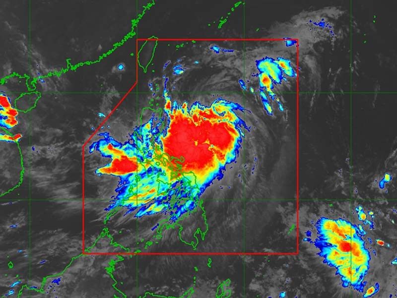
MANILA, Philippines — “Ineng” (Bailu) has intensified into a severe tropical storm, weather forecasters said in a bulletin issued early Friday morning.
Severe Tropical Storm Ineng was last spotted 580 kilometers east of Tuguegarao City, Cagayan with maximum sustained winds of 95 km per hour near the center from the previous 85 kph. Its gusts also gained strength to 115 kph from the previous 105 kph.
It is now moving north northwest slightly faster at 20 kph from the previous 15 kph.
PAGASA raised Tropical Wind Cyclone Signal No. 2 over Batanes. Residents of the province may experience winds between 61 kph and 120 kph in at least 24 hours.
Signal No. 1 is still up over the following areas:
- Cagayan, including Babuyan Group of Islands
- Isabela
- Apayao
- Kalinga
- Northern Abra
- Ilocos Norte
Winds between 30 to 60 kph or intermittent rains may be expected in those areas in at least 24 hours.
The severe tropical storm now has a small chance of making a landfall over Batanes since the area is within the tropical cyclone’s probable track.
“Posible pa rin po itong dumaplis diyan [sa Batanes] (It’s possible that it might graze Batanes),” weather specialist Ariel Rojas said.
“Ineng” may exit the Philippine area of responsibility between late Saturday evening and early Sunday morning.
Moderate to heavy rains may be experienced over Batanes, Cagayan (including Babuyan Group of Islands), Ilocos Norte and Apayao on Friday.
Meanwhile, light to moderate with intermittent heavy rains may affect residents of Metro Manila, Central Luzon, Cavite, Batangas, Mindoro Provinces, northern portions of Palawan (including Calamian and Cuyo Islands), and the rest of Ilocos region, Cordillera Administrative Region and Cagayan Valley.
By Saturday, moderate to heavy rains may affect Ilocos region, CAR, Batanes, Cagayan (including Babuyan Group of Islands) and Mindoro provinces.Meanwhile, light to moderate with intermittent heavy rains may be experienced over Central Luzon, Cavite, Batangas, northern portions of Palawan (including Calamian and Cuyo Islands), Aklan, Antique, Iloilo, Guimaras, and the rest of Cagayan Valley.
Sea travel is risky over the seaboards of areas under TCWS and the eastern seaboards of Central Luzon, Southern Luzon and Visayas.
Forecast positions
- Saturday morning: 150 km east of Basco, Batanes
- Sunday morning: 465 km northwest of Basco, Batanes (outside PAR)
- Monday morning: 975 km northwest of Basco, Batanes (outside PAR)


- Latest
- Trending