Basyang makes landfall over Surigao del Sur
Tropical storm "Basyang" made landfall on Cortes, Surigao del Sur on Tuesday morning.
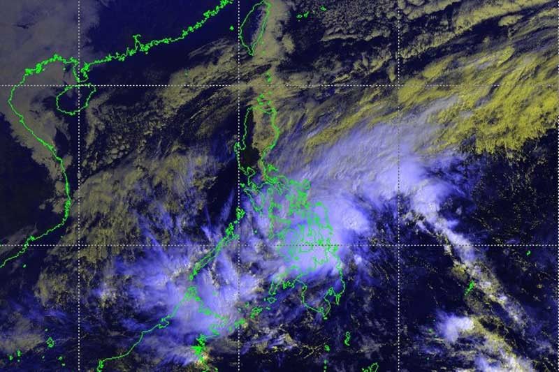
MANILA, Philippines — Tropical storm Basyang (international name: Sanba) made landfall over Cortes, Surigao del Sur at 9:15 a.m. Tuesday, state weather bureau PAGASA said.
Fourteen areas in Visayas and Mindanao have been placed under tropical cyclone warning signal number two:
- Bohol
- Southern Cebu
- Siquijor
- Negros Oriental
- Southern Negros Occidental
- Southern Leyte
- Dinagat Island
- Surigao del Norte
- Surigao del Sur
- Agusan del Norte
- Agusan del Sur
- Camiguin
- Misamis Oriental
- Northern section of Bukidnon
Meanwhile, signal number one is hoisted over the following areas:
- Palawan including Calamian Group of Islands
- Southern section of Masbate
- Aklan
- Capiz
- Antique
- Iloilo
- Guimaras
- Rest of Negros Occidental
- Rest of Cebu
- Leyte
- Biliran
- Samar
- Eastern Samar
- Zamboanga del Sur
- Northern section of Zamboanga del Norte
- Northern section of Zamboanga Sibugay
- Misamis Occidental
- Lanao del Norte
- Lanao del Sur
- Rest of Bukidnon
- North Cotabato
- Compostela Valley
- Davao del Norte
- Northern section of Davao Oriental
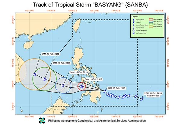
As of 7 a.m. Tuesday, the center of ‘Basyang’ was located at 80 kilometers northeast of Hinatuan, Surigao del Sur. It is expected to move northwest at 25 kilometers per hour.
The tropical storm has maximum sustained winds of 65 kilometers per hour near the center and gustiness of up to 80 kilometers per hour.
The state weather bureau said that there will be scattered to widespread moderate to heavy rains over Visayas, Caraga, Northern Mindanao, Zamboanga Peninsula and the provinces of Davao del Norte, Davao Oriental, Compostela Valley and Lanao del Sur.
“Meanwhile, scattered light to moderate with at times heavy rains is expected over Bicol Region, MIMAROPA and the rest of Mindanao,” it added.
Sea travel remains risky over the seaboards of areas under tropical cyclone warning signal, the seaboards of Northern Luzon and of Visayas, the eastern seaboards of Central Luzon, and the eastern and southern seaboards of Southern Luzon due to the approaching tropical storm and the surge of the northeast monsoon.
Forecast positions
- 24 hours (Wednesday morning): 115 km west northwest of Dumaguete City, Negros Oriental
- 48 hours (Thursday morning): 105 km west of Puerto Princesa City, Palawan
- 72 hours (Friday morning): 75 km west northwest of Pagasa Island, Palawan (Outside PAR)
- 96 hours (Saturday morning): 355 km west northwest of Pagasa Island, Palawan (Outside PAR)


- Latest
- Trending