7.2 quake in Metro to kill thousands
MANILA, Philippines - The powerful earthquake that hit Central Visayas on Tuesday could cause widespread and severe damage if it occurs in highly urbanized Metro Manila and nearby areas, a joint study conducted by government agencies and the Australian government showed.
The study, dubbed Greater Metro Manila Area (GMMA) Risk Analysis Project (RAP), which was released yesterday, showed that a 7.2 magnitude earthquake along the West Valley Fault could kill 37, 054 persons and cause P2.4 trillion in damages.
Philippine Institute of Volcanology and Seismology (Phivolcs) director Renato Solidum said such a powerful quake could also severely injure 16, 000 people.
“A magnitude 7.2 and 6.5 earthquakes along the West Valley Fault can cause severe damage to Metro Manila,†he said during the project launch at the Crowne Plaza Hotel in Quezon City yesterday.
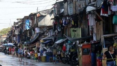
The study estimated the risks for three hazard types – flood, earthquake and severe wind. The towns of Rodriguez, Angono, Cainta, and Taytay and the city of Antipolo in Rizal were included in the study.
Solidum said the new study is “very statistically similar†with the Metro Manila Earthquake Impact Reduction Study, undertaken by Phivolcs, the Metropolitan Manila Development Authority and the Japan International Cooperation Agency in 2004, except that it included the estimated economic losses.
The project was a product of a three-year study by Phivolcs, Philippine Atmospheric, Geophysical and Astronomical Services Administration, Mines and Geosciences Bureau, National Mapping and Resource Information Authority, Office of the Civil Defense and Geoscience Australia.
It received funding amounting to A$5.55 (around P229 million) from the Australian government, through the Australian Agency for International Development.
The Light Detection and Ranging or LiDAR technology, which uses light waves to capture high-resolution images on the ground, was used.
LiDAR produces data and images on type and heights of building, land use and land cover, which are vital in determining people, assets, and activities that will be affected by a hazard.
The government agencies also developed an exposure database, which includes data on administrative boundaries, land ownership, building construction statistics, demographics or socioeconomic characteristics of communities.
Part of the project is the distribution of 87 multi-hazard and risk maps to local executives in Metro Manila.
Australian Ambassador Bill Tweddell and government officials involved in disaster mitigation turned over the maps to Metro Manila local executives led by Quezon City Mayor Herbert Bautista yesterday.
“Natural hazards do not have to lead to disasters, especially if we are able to carefully assess the risk of an area and properly plan for the long term,†Tweddell said.
The comprehensive risk assessment maps covering the Greater Metro Manila Area are available to local officials and the public through www.geoportal.gov.ph.
Disaster mitigation
Meanwhile, Ateneo de Manila University through the Ateneo Institute of Sustainability sponsored a lecture by Seiji Suwa of Kobe, Japan, wherein he shared his knowledge in disaster mitigation with various academic units.
Suwa was an English teacher at Maiko High School in Kobe, having gone through the experience of the Great Hanjin-Awaji Disaster (also known as the Kobe earthquake), a 6.8 magnitude tremor, which devastated the area in January 1995.
In the lecture, Suwa said that to improve disaster mitigation efforts, it was important to prepare for the eventuality of an earthquake and not merely react to it.
“Preparation is the most important factor,†Suwa said, adding “preparation is better than reaction.â€
He recommended that disaster mitigation efforts should be integrated into science courses in schools.
It is because of these disasters, Suwa said, that Japan is now leading in Disaster Mitigation Education.
Suwa’s lecture has become even more relevant with the 7.2 magnitude earthquake that demolished Bohol’s heritage churches last Oct. 15.


- Latest
- Trending