Philippine Navy denies China expelled ship in Panatag
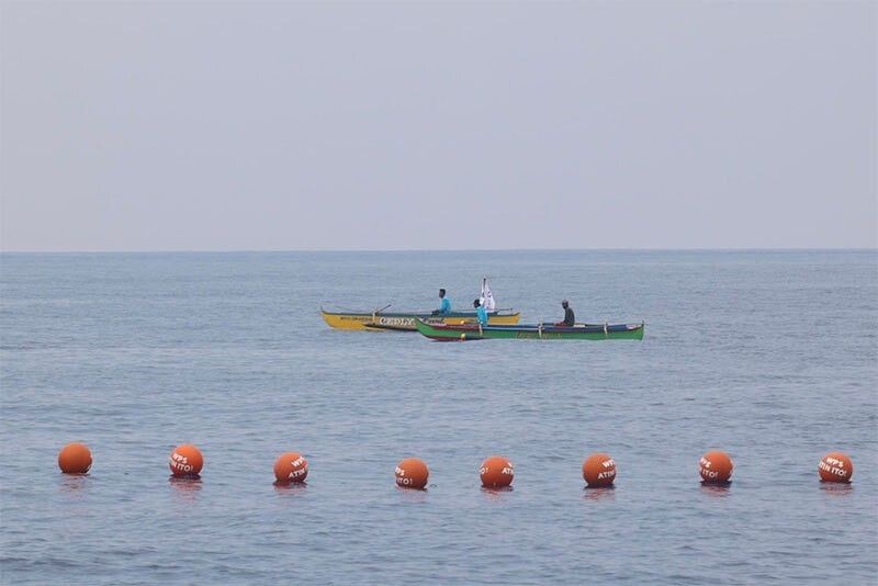
MANILA, Philippines — The Philippine Navy yesterday debunked what it described as another Chinese propaganda, this time claiming that the latter had expelled a Philippine ship from Panatag Shoal, also known as Scarborough and Bajo de Masinloc.
China said that on Sunday, the Apolinario Mabini allegedly intruded into the waters of Panatag without Chinese approval. It said that soon after, the People’s Liberation Army Southern Theater Command’s navy organized forces to track, monitor, warn and expel the Philippine ship.
Philippine Navy spokesperson for the West Philippines Sea (WPS) Commodore Roy Vincent Trinidad said China’s claim is “part of shaping or malign info operations more likely for their internal audience.”
“Only the Philippine Navy and other Philippine-flagged law enforcement ships have the authority and legal bases to challenge any ship within maritime zones,” Trinidad said.
On a similar note, the National Task Force for the West Philippine Sea (NTF WPS) slammed China for saying the latter granted permission for a Philippine resupply mission in Ayungin Shoal.
The task force emphasized that Manila does not need permission for its mission in Philippine waters.
“The Philippines firmly asserts that no permission was sought from, nor granted by, China for the conduct of our lawful and regular Rotation and Resupply (RoRe) mission to our troops stationed aboard BRP Sierra Madre (LS57) in Ayungin Shoal on 04 March 2025,” the NTF WPS said.
Ayungin Shoal is a feature well within the Philippines’ exclusive economic zone (EEZ) and continental shelf, as affirmed by the 2016 Arbitral Award. The Philippines has sovereign rights and jurisdiction over the area and has been conducting RoRe missions independently, in accordance with international law, particularly the United Nations Convention on the Law of the Sea (UNCLOS).
“China’s claim that it ‘granted permission’ for this mission is a blatant disinformation attempt to undermine Philippine sovereignty and mislead the international community,” the National Security Council said.
“The Philippines does not recognize any authority of China over Ayungin Shoal, and we categorically reject any implication that our actions require their approval,” it added.
Marcos: West Philippine Sea is ours
President Marcos was elated by the inclusion of the WPS label in Google Maps even as Malacañang echoed a National Maritime Council (NMC) statement that the initiative of the popular web mapping platform shows the “growing acceptance” of the country’s “lawful entitlements” over its waters.
“Definitely (the President) was happy… because this is not just for us, it’s for the entire country,” President Communications Undersecretary Claire Castro said at a press briefing yesterday.
“This is something we strive for – the recognition of the West Philippine Sea as ours,” she said.
Google Maps has formally labeled the waters off Palawan as West Philippine Sea, which pertains to the portion of the South China Sea that is within the Philippines’ 200-nautical mile EEZ and continental shelf.
In an April 18 statement, the NMC said the initiative of Google Maps was “a reflection of the growing acceptance that the waters of the West Philippine Sea are within our sovereignty, sovereign rights and jurisdiction, in accordance with the 1982 UNCLOS and the 2016 South China Sea Arbitral Award, and as bolstered by Republic Act 12064 or the Philippine Maritime Zones Act.”
“The use of the West Philippine Sea label in a global platform, such as Google Maps, raises domestic and international public awareness regarding the Philippines’ lawful maritime entitlements,” the NMC said.
Marcos signed the Philippine Maritime Zones Act in November last year that clearly defines the extent and boundaries of the country’s maritime zones.
In a recent statement, Google said the West Philippine Sea has always been on Google Maps but the label has recently been made “easier to see.”
In 2012, then president Benigno Aquino III issued an administrative order renaming the waters west of the Philippines within its EEZ as West Philippine Sea.
Under Administrative Order 29, the West Philippine Sea refers to the maritime areas on the western side of the Philippine archipelago which includes the Luzon Sea, the waters around, within and adjacent to the Kalayaan Island Group and Bajo de Masinloc.
The Philippines has been demanding that China adhere to international laws, including the 1982 UNCLOS and the 2016 arbitral ruling, which invalidated Beijing’s sweeping claims in the South China Sea.
Under the UNCLOS, states have sovereign rights to explore, exploit, and conserve and manage natural resources within their EEZ. – Helen Flores


- Latest
- Trending