'Auring' accelerates slightly as it nears Eastern Visayas, Caraga
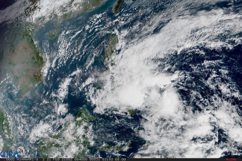
MANILA, Philippines — (Updated 5:50 p.m.) Weather bureau PAGASA on Sunday said Tropical Storm Auring (international name: Dujuan) slightly accelerated as it approaches the Eastern Visayas-Caraga area.
In its latest bulletin, the agency said Auring is now moving at a speed of 20 kilometers per hour at a northwestward direction.
PAGASA said it will continue to move in this direction in the next 48 hours and based on its forecast track and probability cone, could initially make landfall over the areas of Dinagat Islands-Eastern Samar-Leyte on Monday morning.
The tropical storm was last seen at 355 km east of Surigao City in Surigao del Norte, and retained its strength of 65 kph peak winds near the center and gusts of up to 80 kph.
"Auring is forecast to maintain its strength in the next 12 hours," state meteorologists said. "However, the likelihood of weakening into tropical depression before it makes landfall is not yet ruled out. After landfall, Auring is forecast to weaken considerably due to significant terrain interaction and the increasing wind shear, leading to deterioration into a remnant low within 48 hours, possibly sooner."
From Sunday to morning of February 22, Auring is expected to bring moderate to heavy rains over Caraga, Eastern Visayas, Misamis Oriental, Bukidnon, Camiguin, Catanduanes, Albay and Sorsogon.
Light to moderate with ocassional heavy rains, meanwhile, will be experienced over Zamboanga Peninsula, MIMAROPA, Davao Oriental, as well as in Davao de Oro, Quezon province, and the rest of Bicol Region, Visayas and Northern Mindanao.
From Monday morning to Tuesday morning, Auring will also bring moderate to heavy rains over Bicol, Marinduque, Northern Samar, Eastern Samar, and Samar, as well as light to moderate with at times heavy rains over the rest of Visayas, Bicol, MIMAROPA, Quezon, Aurora, Isabela, and Cagayan.
"Under these conditions, scattered flooding (including flash floods) and rain-induced landslides are likely during heavy or prolonged rainfall especially in areas that are highly or very highly susceptible to these hazards as identified in hazard maps," PAGASA said.
Disaster response officials earlier today said more than 5,000 individuals are currently in evacuation shelters due to Auring, with over 4,200 stranded in various ports across the country.
While the extent of its damage has yet to be determined, photos on social media have shown flooded areas as well as rescue personnel conducting operations to those affected. Per the NDRRMC, some 44 houses in Surigao del Norte and Surigao del Sur were also partially damaged due to Auring.
As of 5 p.m. of February 21, the following areas are still under PAGASA's tropical cyclone wind signals:
Signal No. 2 (61 to 120 kph winds prevailing or expected in 24 hours)
Visayas
- Central and southern portions of Eastern Samar (Sulat, Taft, San Julian, Borongan City, Maydolong, Balangkayan, Balangiga, Lawaan, Llorente, Hernani, General Macarthur, Quinapondan, Giporlos, Salcedo, Mercedes, Guiuan)
- Central and southern portions of Samar (Hinabangan, Calbiga, Pinabacdao, Villareal, Basey, Marabut, Santa Rita)
- Eastern portion of Leyte (Babatngon, Tacloban City, San Miguel, Alangalang, Santa Fe, Palo, Tanauan, Pastrana, Dagami, Tabontabon, Tolosa, Julita, Burauen, Dulag, La Paz, Mayorga, Macarthur, Javier, Abuyog, Mahaplag)
- Eastern portion of Southern Leyte(Silago, Sogod, Hinunangan, Libagon, Saint Bernard, Hinundayan, Anahawan, San Juan, Liloan, San Francisco, San Ricardo, Pintuyan)
Mindanao
- Dinagat Islands
- Surigao del Norte, including Siargao and Bucas Grande Islands
Signal No. 1 (30 to 60 kph winds prevailing or expected in 36 hours)
Luzon
- Sorsogon
- Masbate, including Ticao and Burias Islands
- Albay
- Catanduanes
- Eastern portion of Camarines Sur (Caramoan, Presentacion, Sagnay, Buhi, Iriga City, Nabua, Bato, Balatan)
- Eastern portion of Romblon(Magdiwang, San Fernando, Cajidiocan)
Visayas
- Northern Samar
- rest of Eastern Samar
- Samar
- Biliran
- Leyte
- Southern Leyte
- Cebu
- Bohol
- Siquijor
- Negros Oriental
- Northern and central portions of Negros Occidental (Kabankalan City, Himamaylan City, Binalbagan, Isabela, Moises Padilla, Hinigaran, La Castellana, Pontevedra, San Enrique, La Carlota City, Pulupandan, Valladolid, Bago City, Murcia, Bacolod City, Talisay City, Silay City, Enrique B. Magalona, Victorias City, Manapla, Cadiz City, Sagay City, Escalante City, Toboso, Calatrava, San Carlos City, Salvador Benedicto)
- Northern and central portions of Iloilo (Carles, Balasan, Estancia, Batad, San Dionisio, Sara, Concepcion, Lemery, Ajuy, San Rafael, Passi City, Bingawan, Calinog, Lambunao, Duenas, San Enrique, Dingle, Anilao, Banate, Janiuay, Badiangan, Pototan, Barotac Nuevo, Dumangas, Mina, Maasin, Alimodian, Leon, Tigbauan, Oton, Iloilo City, Pavia, San Miguel, Cabatuan, Santa Barbara, New Lucena, Zarraga, Leganes, Barotac Viejo)
- Capiz
- Guimaras
- Eastern portion of Aklan (Tangalan, Malinao, Makato, Lezo, Numancia, Kalibo, New Washington, Batan, Altavas, Balete, Banga, Madalag, Libacao)
Mindanao
- Surigao del Sur
- Agusan del Norte
- Agusan del Sur
- Davao Oriental
- Davao de Oro
- Davao del Norte
- Davao City
- Camiguin
- Misamis Oriental
- Bukidnon
Forecast Position
Monday afternoon: 75 km South of Masbate City, Masbate
Tuesday afternoon: 100 km North Northwest of Coron, Palawan


- Latest
- Trending