April launch seen for Philippine satellite
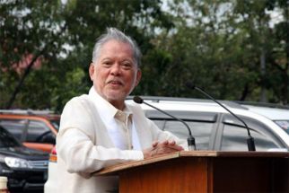
MANILA, Philippines – The country will see the launching of its first satellite in April, Department of Science and Technology (DOST) Secretary Mario Montejo said.
He said the schedule was set after the DOST firmed up the arrangements with an American provider of space shuttle services on which the “micro satellite” would be launched.
Select scientists from the DOST are now in Japan, collaborating with space scientists from Hokkaido University, in the assembly of the micro satellite.
Though the assembly is now getting much assistance from Japanese scientists, Montejo said the Filipino scientists are doing the actual design and fabrication activities.
DOST Assistant Secretary Raymund Liboro said the micro satellite will be a key component of the cutting edge remote sensing technology capability being developed by the DOST, which will use satellite imagery and ground data processing to generate data and information on agricultural and also marine and mountain conditions.
Liboro said the remote sensing technology research and development effort of the DOST was greatly benefited by the DOST’s recent hosting of the 2015 Asian Conference on Remote Sensing during which it gathered the world’s foremost experts and resource persons last October.
He said the DOST and scientists and researchers of the Philippine Atmospheric, Geophysical, Astronomical Services Administration were able to confer with these experts.
“For monitoring our forests, we will use the satellites we hope to launch by next year,” Liboro told The STAR.
Enrico Paringit, head of the DOST’s Project DREAM (Disaster Risk Exposure Assessment for Mitigation), explained that through the said technology, experts can make an inventory of the agricultural resources and immediately discover any irregularities in the crops before these spread.
“The El Niño phenomenon was detected using remote sensing technologies,” Paringit said.
He said remote sensing technology has benefits in the areas of agriculture, forestry and disaster mitigation.
Remote sensing is the technology used in getting information on an object or phenomenon without making any physical contact. It is done through aerial scanning of a location or through satellite images.
“We can say that remote sensing is more like feeling without touching,” Paringit said.
Under the DREAM program which Paringit heads, DOST will be sending two micro satellites in two years starting 2016 to enable the remote transmission of data.
These images will be verified using data coming from other sources.
The data will be obtained on a daily basis and will be sent to a ground receiving station in Subic, Zambales. The station, to be called the Philippine Earth Data Resources and Observation Center (PEDRO), will provide crops and climate experts with information on a particular area’s vegetation conditions.
It will also receive, process and distribute spatial data to provide government officials with intelligent decision-making tool on various areas of concern such as the occurrence of pests, annual yield of rice to prevent shortages in production and other issues.
- Latest
- Trending


