


Tropical Cyclones 2018
PAGASA says the Philippines can expect one to two tropical cyclones to enter in its area of responsibility in November.
PAGASA senior weather specialist Chris Perez adds in an update streamed online early Friday that the country experiences tropical cyclones of stronger intensity during the last quarter of every year.
He said their forecast is based on PAGASA's data from 1948 to 2017.
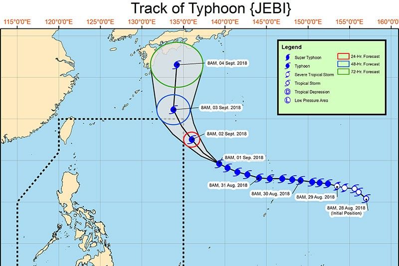
PAGASA says Typhoon Jebi is expected to enter the Philippine area of responsibility briefly this afternoon or evening but poses no direct threat to any part of the country.
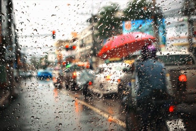
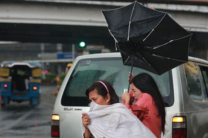
Although outside the Philippine area of responsibility, state weather bureau PAGASA says Severe Tropical Storm Cimaron and Typhoon Soulik are enhancing the southwest monsoon, which prevails over the western part of Luzon.
PAGASA says monsoon rains are expected over the regions of Ilocos and Cordillera, Zambales, Bataan, Batanes, and the Babuyan Group of Islands.
At 3 a.m. today, the eye of "Cimaron" was located at 2,595 km east of extreme northern Luzon while the center of "Soulik" was spotted at 1360 km north-east of extreme northern Luzon.
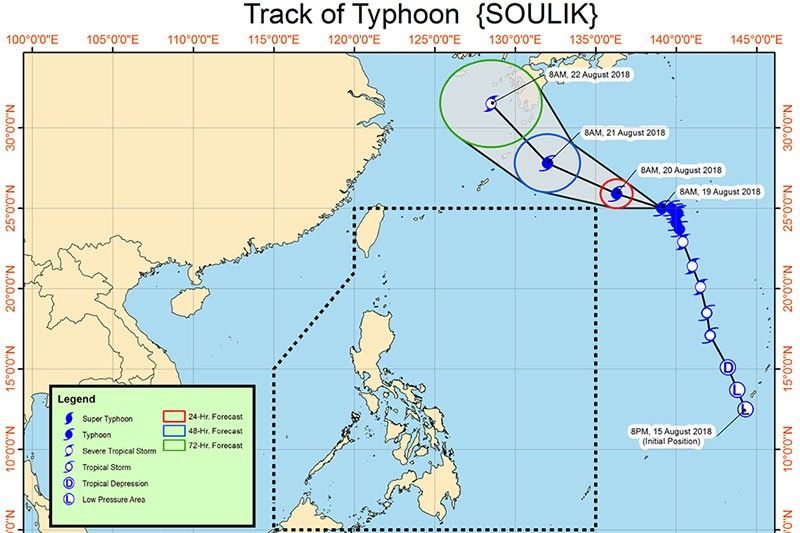
A stronger Typhoon Soulik is still being monitored by state weather bureau PAGASA but adds that it will have no direct effect over the country.
In its advisory past 11 a.m., PAGASA said "Soulik" packs maximum winds of 145 kph near the center and gustiness of up to 180 kph.
In its forecast around 5 p.m., however, it said the typhoon outside the Philippine area of responsibility has strengthened, packing winds of 160 kph and gustiness of up to 195 kph.
Another tropical storm with the international name "Cimaron" is also being monitored by PAGASA. Its center was spotted at 1,780 km east-northeast of Basco, Batanes at 3 p.m. today.
PAGASA meteorologist Ariel Rojas says that the name was contributed by the Philippines.
"Ang ibig sabihin nito ay Philippine wild ox," he says.
Both are not seen to enter PAR.
The southwest monsoon, however, still prevails in the western part of Luzon.
PAGASA is monitoring Typhoon Soulik outside the Philippine area of responsibility.
Although not likely to enter PAR, PAGASA says "Soulik" may slightly enhance the habagat and bring occasional moderate to heavy rain across extreme northern Luzon on Tuesday, August 21.
The typhoon's eye was located at 1,800 km east-northeast of extreme northern Luzon at 10 a.m. today.
PAGASA says it is monitoring a low pressure area that is projected to develop into a tropical depression within the next 24 hours.
As of 4 p.m., PAGASA weather specialist Samuel Duran said the LPA is located 780 kilometer east of Basco, Batanes.
Duran said the LPA continues to enhance the southwest monsoon bringing rains over some parts of the country.

The low pressure area PAGASA is monitoring has entered the Philippine area of responsibility.
It is located at 1,030 km east of Basco Batanes as of 4 a.m.
It may turn into a tropical cyclone in the next 24-48 hours.
PAGASA says the combined effects of Tropical Depression Domeng and the monsoon trough will result in occasional heavy rains over Bicol and western sections of Mimaropa and Visayas regions today.
The center of “Domeng” was spotted at 835 kilometers east of Casiguran, Aurora as of 11 a.m. today.
It packs maximum sustained winds of up to 55 kph near the center and gustiness of up to 65 kph.
PAGASA is also monitoring another weather disturbance outside the Philippine area of responsibility.
PAGASA says moderate to heavy monsoon rains are expected over Mimaropa and Western Visayas starting Friday and over the rest of the western section of Luzon, including Metro Manila, during the weekend due to Tropical Depression Domeng.
"Domeng" continues to move in a north-northwest direction at 15 kph.
The center of the tropical depression was spotted at 605 km east of Virac, Catanduanes as of 3 a.m. today.
It packs maximum sustained winds of 45 kph and gustiness of 60 kph.
PAGASA says "Domeng" still maintains its strength as it barrels in a northwestward direction. It packs maximum sustained winds of 45 kph near the center and gustiness of up to 60 kph.
"Domeng" is forecast to bring moderate to occasionally heavy rains over the regions of Eastern Visayas and Bicol today.
Although it is not likely to make landfall, it may trigger the habagat, bringing moderate to occasionally heavy rains over Mimaropa and Western Visayas starting Thursday, and over the rest of the western section of Luzon, including Metro Manila, starting Friday.
Tropical Depression Domeng has maintained its strength, PAGASA says. It packs maximum sustained winds of 45 kph near the center and gustiness of up to 60 kph.
As of 3 a.m. today, the center of "Domeng" was spotted at 700 km east of Guiuan, Eastern Samar.
It is forecast to move northwest at 15 kph and is estimated to exit the Philippine area of responsibility on Sunday morning.
No Tropical Cyclone Warning Signals are raised.
The LPA east of Mindanao has developed into a tropical depression and named "Domeng," PAGASA says.
Tropical Depression Domeng is expected to bring moderate to occasionally heavy rains and thunderstorms over Eastern and Central Visayas, Caraga and Davao.
It is not expected to make landfall.
As of 10 a.m. today, "Domeng" was estimated to be 675 km east of Guiuan, Eastern Samar.
PAGASA is monitoring an LPA embedded in the Intertropical Convergence Zone that may develop into a tropical depression within 24 hours and will be named "Domeng."
It was spotted 795 km east of Surigao City, Surigao del Norte as of 3 a.m. today.
The likelihood of a landfall is very small but it may enhance the southwesterly surface wind flow and bring moderate to heavy rains over the eastern section of the country.
Tropical Storm Jelawat has entered the Philippine area of responsibility at 8 a.m. today and was named "Caloy." It was estimated at 1,025 km east of Surigao City, Surigao del Norte.


- Latest
- Trending


 Partner


