‘Huaning’ enters PAR, Signal No. 1 up in Luzon
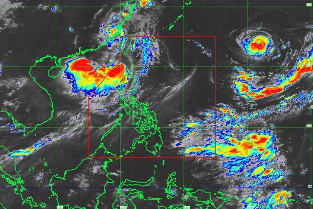
Satelite image of Tropical Storm "Huaning" as of 10 a.m. PAGASA / Released
MANILA, Philippines — Another weather disturbance, Tropical Storm “Huaning”, entered the Philippine Area of Responsibility on Sunday morning in the wake of Typhoon "Gorio".
PAGASA said that at 10 a.m., the center of Huaning (international name Haitang) was located 250 kilometers west of Basco, Batanes.
It has maximum sustained winds of up to 75 kilometer per hour near the center and gustiness of up to 90 kph.
“Huaning is expected to make landfall over Southern Taiwan tonight,” the state weather bureau said in its advisory.
PAGASA raised Tropical Cyclone Warning Signal No.1 over the following provinces in Luzon:
- Batanes,
- Ilocos Norte,
- Ilocos Sur,
- Apayao,
- Abra,
- and Northwestern Cagayan including Babuyan Group of Islands.
The weather bureau said the tropical cyclone warning signal is expected to remain for the next 36 hours.
It added that Huaning’s estimated rainfall amount is from moderate to heavy within the storm's 500-kilometer diameter.
PAGASA warned the wind could cause light damage to low risk structures, slight damage to some houses of vey light materials or makeshift structures in exposed communities.
It said that with 30 to 60 kph winds, some banana plants are expected to be tilted, a few downed and leaves are generally damaged while twigs of small trees may be broken.
PAGASA sad rice crops may suffer significant damage when it is in its flowering stage.


- Latest
- Trending