PhilSA uses satellite data to spot new fishing grounds
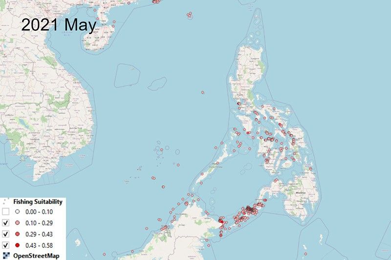
MANILA, Philippines — While NASA is looking at distant galaxies to better understand the universe, the Philippine Space Agency is using satellite data to scout potential fishing grounds for Filipino fisherfolk.
Initial results from a study of PhilSA found that the municipal waters of Sulu and Negros Occidental have a high probability as suitable fishing areas.
"We are able to locate some areas within and outside the municipal boundaries that are potential fishing grounds aside from the existing core fishing areas," said Mark Jayson Felix, senior science research specialist with PhilSA's Earth Sciences Space Mission Studies Division.
According to the agency, satellite data such as chlorophyll-a concentration, sea surface temperature and data on bathymetry—or the measurement of the depth of water in oceans—were used to capture the environmental conditions of the sea.
The concentration of chlorophyll-a is an indicator of phytoplankton abundance and biomass in coastal waters.
Night light data was also used to serve as a proxy to represent suitable areas for fishing.
Felix noted the potentially new fishing grounds vary with the seasonality or month of the year.
Which areas are unlikely fishing grounds?
The waters of Ilocos Norte and Ilocos Sur, as well as the eastern parts of Eastern Visayas and Davao region showed a low probability as suitable fishing areas.
“In general, deeper areas with very low chlorophyll-a concentration are observed to be unlikely fishing grounds,” Felix said.
He, however, noted that such findings still need validation from the ground.
How will the effort benefit fishers?

PhilSA said the initiative, which began in 2021, aims to come up with a countrywide fishing areas map that will provide a cost-effective guide to fishermen.
“These potential grounds may be an alternative location, especially for local fisherfolk,” Felix said.
“And since a lot of these potential fishing grounds are within the municipal boundaries, local government units may regulate the fishing activities in these areas for sustainable use and in a manner that will mainly benefit the small-scale fisherfolk,” he added.
Small-scale fishers—among the poorest sectors in the country—face decline in fish catch due to overfishing, illegal fishing practices, intrusion of commercial fishing vessels into municipal waters, and development projects.
In 2020, the volume of fisheries production was 4.4 million metric tons, data from the Philippine Statistics Authority showed. Of the total, 25.05% came from municipal fisheries. Aquaculture accounted for 52.79% of the country’s fisheries production, while commercial fisheries accounted for 22.16%.
PhilSA said it is coordinating with the Bureau of Fisheries and Aquatic Resources and the National Fisheries Research and Development Institute to work on field validation and experts’ assessment.







- Latest