Tropical Depression Ramil intensifies slightly; storm surge warning out
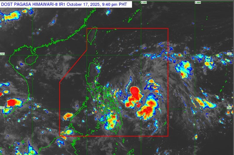
MANILA, Philippines — Tropical Depression Ramil is expected to make landfall over Catanduanes today as it continues to move west-southwest over the Philippine Sea, according to the Philippine Atmospheric, Geophysical and Astronomical Services Administration (PAGASA).
The center of Ramil was last located 640 kilometers east of Juban, Sorsogon yesterday, with maximum sustained winds of 55 kilometers per hour near the center and gustiness of up to 70 kph.
The tropical depression was moving west-southwest at 25 kph, with strong winds extending up to 400 kilometers from its center.
Tropical Cyclone Wind Signal No. 1 remains in effect over several provinces in Luzon and the Visayas including Catanduanes, Albay, Camarines Norte, Camarines Sur, Sorsogon, Burias Island, Ticao Island, Aurora, Quezon, including Polillo Islands, the eastern portion of Nueva Ecija, and parts of Isabela, Quirino and Nueva Vizcaya, as well as Northern Samar and portions of Eastern and Western Samar.
PAGASA said Ramil may intensify into a tropical storm within 12 hours and possibly reach severe tropical storm category before landfall, in which case Signal No. 2 or 3 could be raised in more areas.
Based on PAGASA’s forecast track, Ramil’s first landfall will be over Catanduanes this afternoon, before it passes close to or over the mainland Bicol Region this evening.
A storm surge of one to two meters may occur within 48 hours over low-lying and coastal areas of Isabela, Aurora, Quezon, including Polillo Islands, Camarines Norte, Camarines Sur, Catanduanes, Albay, Sorsogon, Northern Samar, Eastern Samar and Samar.
Sea travel is discouraged, particularly for small seacraft, as rough to very rough seas are expected over the northern and eastern seaboards of Catanduanes and Camarines Sur, with wave heights reaching up to 4.0 meters. Moderate to rough conditions are also likely along the eastern seaboards of Luzon and Visayas, where waves may reach up to 2.5 meters.
By early Sunday morning Ramil may make a second landfall over Aurora or Quezon before crossing Northern or Central Luzon.
It is projected to emerge over the West Philippine Sea by Sunday afternoon or evening and exit the Philippine area of responsibility by Monday.
PAGASA noted that a southward shift in the cyclone’s track could bring its center closer to the Bicol Peninsula and result in more areas being placed under higher wind signals.
PAGASA advised residents in low-lying and mountainous areas to remain alert for possible flash floods and landslides, especially in areas already saturated by previous rains.
The weather bureau urged local government units and residents in affected areas to take precautionary measures, including preparing for possible evacuation, and to stay updated on the latest advisories.


- Latest
- Trending