


Quedan enters PAR
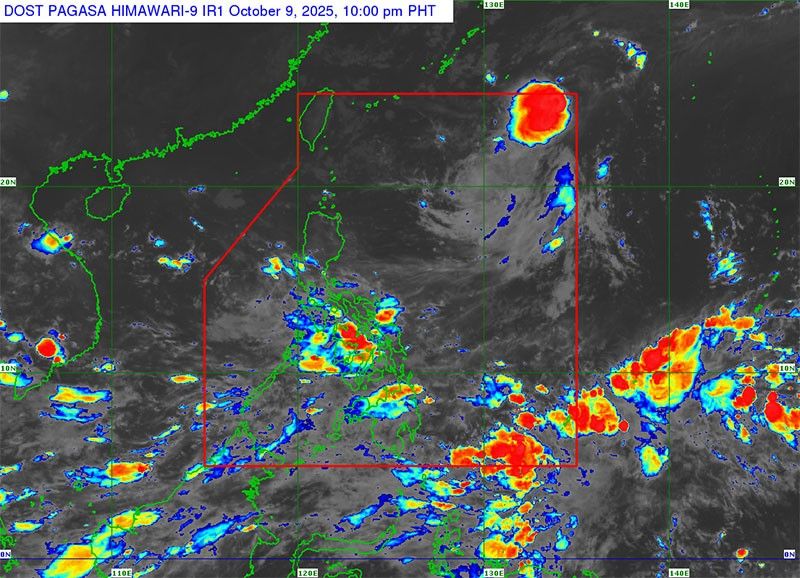
MANILA, Philippines — Tropical Storm Quedan (international name Nakri) entered the Philippine area of responsibility (PAR) yesterday afternoon, but is not expected to directly affect the country’s weather conditions, according to the Philippine Atmospheric, Geophysical and Astronomical Services Administration.
PAGASA said the center of Quedan was last located 1,370 kilometers east-northeast of extreme Northern Luzon, with maximum sustained winds of 75 kilometers per hour near the center and gusts of up to 90 kph.
It is moving north-northwest at 30 kph.
The weather bureau said that Quedan’s strong to gale-force winds extend outward up to 360 kilometers from the center.
No tropical cyclone wind signal has been raised over any part of the country as of yesterday afternoon.
Despite Quedan’s presence within PAR, PAGASA said it is “less likely to directly affect the weather conditions in the country.”
The agency warned, however, that other weather systems – including the southwesterlies, a low-pressure area and the northeasterly wind flow – may bring strong to gale-force gusts, particularly over coastal and upland areas in several parts of the country.
Gusty conditions are expected today over Batanes, Babuyan Islands, Ilocos Norte, Palawan, Negros Oriental, Siquijor, Cebu, Bohol, Leyte, Southern Leyte, Eastern Samar, Dinagat Islands, Surigao del Norte, Northern Mindanao, Zamboanga del Norte and Davao provinces.
Tomorrow, gusts may persist over Ilocos Norte, Palawan, Romblon, Masbate, Western Visayas, Negros Island Region, Central Visayas, Zamboanga del Norte and Misamis Occidental.
PAGASA said Quedan is expected to continue moving northwestward and may exit the PAR by late Thursday night or early Friday morning as it heads toward Ryukyu Islands, where it is forecast to further intensify.


- Latest
- Trending


