


Egay intensifies further
MANILA, Philippines — Tropical cyclone Egay is forecast to steadily increase in strength and may reach the severe tropical storm category today as state weather forecasters are not ruling out a possible landfall scenario over Northern Luzon.
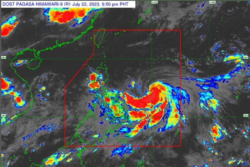
The Philippine Atmospheric, Geophysical and Astronomical Services Administration (PAGASA) said that Egay was monitored at 685 kilometers east of Virac town in Catanduanes at 3 p.m. yesterday.
It was packing maximum sustained winds of 75 kilometers per hour near the center and gustiness of up to 90 kph while moving westward at 15 kph.
Current forecast tracks indicate that Egay will remain offshore over the Philippine Sea but a landfall scenario over the northern portion of Northern Luzon is not being ruled out.
It is forecast to reach its peak as a super typhoon by Tuesday or Wednesday while still over the Philippine Sea.
Egay may also enhance the southwest monsoon this week, with occasional rains likely over Western Visayas, Occidental Mindoro and the northern portion of Palawan including Calamian Islands.
The enhanced southwest monsoon will bring gusty conditions over MIMAROPA, most of the Visayas, the northern portions of Northern Mindanao and Caraga and portions of Zamboanga Peninsula.
Tropical cyclone wind signals could be hoisted over some areas in the Bicol Region and Eastern Visayas.
PAGASA said the trough of Egay is already bringing scattered rainshowers over Bicol Region and Eastern Visayas.


- Latest
- Trending


