


Tropical Storm Karding slightly accelerates as it keeps strength
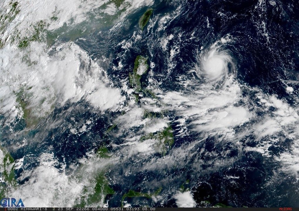
MANILA, Philippines — Tropical Storm Karding has kept its strength, packing winds of 65 kilometers per hour near the center and gusts of up to 80 kph, as it moved slightly faster and approached closer to land, state weather service PAGASA said in a bulletin issued Friday at 5 a.m.
PAGASA said tropical cyclone wind signals may be hoisted over the eastern portions of Northern and Central Luzon as early as Friday night in anticipation of strong breeze to near gale strength winds.
It said the highest wind signal it may hoist is Signal No. 2, but it is not ruling out the possibility of raising Signal No. 3.
Karding, now moving westward at 10 kph, is forecast to make landfall on Sunday over the east coast of Northern Luzon as either a “high-end tropical storm or a low-end severe tropical storm.”
Batanes, Cagayan and Isabela may experience light to moderate with at times heavy rains beginning Sunday midnight until morning.
Meanwhile, moderate to heavy rains are expected the rest of Sunday through early Monday morning over Cordillera Administrative Region, Cagayan, Isabela, Ilocos provinces and La Union.
It is also forecast that the northern portion of Aurora and the rest of Ilocos Region and Cagayan Valley will experience light to moderate with at times heavy rains.
“Under these conditions, isolated to scattered flooding and rain-induced landslides are possible,” PAGASA warned.
Beginning Sunday, occasional rains may also occur over most of Southern Luzon and Visayas, especially over their western sections, as Karding influences the southwest monsoon or habagat.
PAGASA also warned small seacrafts that sailing may be risky as the northeasterlies may bring moderate to rough seas over the northern and western seaboards of Northern Luzon by Saturday, which may prevail until Sunday. These conditions may extend to the eastern seaboard of Central Luzon due to Karding.
After making landfall on Sunday and crossing the mountainous terrain of Northern Luzon, Karding is expected to continue tracking over the West Philippine Sea, where it will likely emerge as a tropical storm.
Forecast position
- September 23, 2 p.m. - 1,085 km East of Northern Luzon
- September 24, 2 a.m. - 855 km East of Northern Luzon
- September 24, 2 p.m. - 610 km East of Tuguegarao City, Cagayan
- September 25, 2 a.m. - 305 km East of Tuguegarao City, Cagayan
- September 25, 2 p.m. - In the vicinity of Sapinit, Isabela
- September 26, 2 a.m. - 140 km West Southwest of Sinait, Ilocos Sur
- September 27, 2 a.m. - 865 km West of Northern Luzon (outside PAR)


- Latest
- Trending


