


PAGASA: Tropical Storm Maring, Tropical Depression Nando may merge
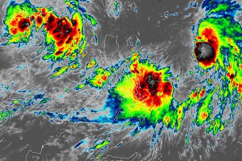
MANILA, Philippines (Updated 12:30 p.m.) —Tropical Storm Maring (Kompasu) and Tropical Depression Nando may merge within 24 hours, the state weather bureau said on Saturday morning.
PAGASA said the two weather systems inside the Philippine area of responsibility are embedded within a larger circulation of a monsoon depression, and are interacting with one another.
Maring “may likely persist in the merger event with Nando,” it said. The resulting merger cyclone may reach severe tropical storm category within 36 hours.
It is expected to cross the Luzon Strait and pass over or close to Batanes and Babuyan Islands between Monday evening and Tuesday morning.
PAGASA noted there is a “moderate to high likelihood” that changes may still occur in the forecasts given the trend of changes observed and the uncertainty of the merger event between the two cyclones.
Maring
Maring was last seen 820 kilometers east of Virac, Catanduanes, packing peak winds of 85 km per hour near the center and gusts of up to 105 kph.
It is heading west northwest at 15 kph.
PAGASA said that moderate to heavy rains are possible in Catanduanes, Eastern Visayas and Dinagat Islands. Residents of northern portion of Palawan including Calamian and Cuyo Island, Occidental Mindoro, and the rest of Bicol region, Caraga and Visayas may also experience light to moderate with at times heavy rains.
Weather forecasters also said that occasional gusts may still be experienced in Eastern Visayas, Caraga, Catanduanes, Albay and Sorsogon even with the absence of a wind signal due to the “expansive wind field of the tropical storm.”
Tropical Cyclone Wind Signal No. 1 may be raised for some areas in Northern Luzon beginning Saturday or Sunday.
A gale warning was also issued for the eastern seaboards of Southern Luzon, Visayas and Mindanao.
Nando
At 10 a.m., Nando was located 930 km east of Northern Luzon, with maximum sustained winds of 45 kph and gusts of 55 kph.
It accelerated, now moving west southwest at 45 kph.
PAGASA said the tropical depression is unlikely to directly affect the weather conditions and the sea conditions in the country within the forecast period.
Nando is expected to be assimilated and merged into the circulation of Maring.
Forecast position of Maring
- Sunday morning: 820 km east of Central Luzon
- Monday morning: 400 km east of Aparri, Cagayan
- Tuesday morning: 175 km west of Calayan, Cagayan
- Thursday morning: 735 km west of Calayan, Cagayan (outside PAR)
- Friday morning: 1,410 km west of extreme Northern Luzon (outside PAR)
Forecast position of Nando
- Sunday morning: 695 km east of Infanta, Quezon


- Latest
- Trending


