


Signal No. 1 up over Metro Manila due to Typhoon Jolina
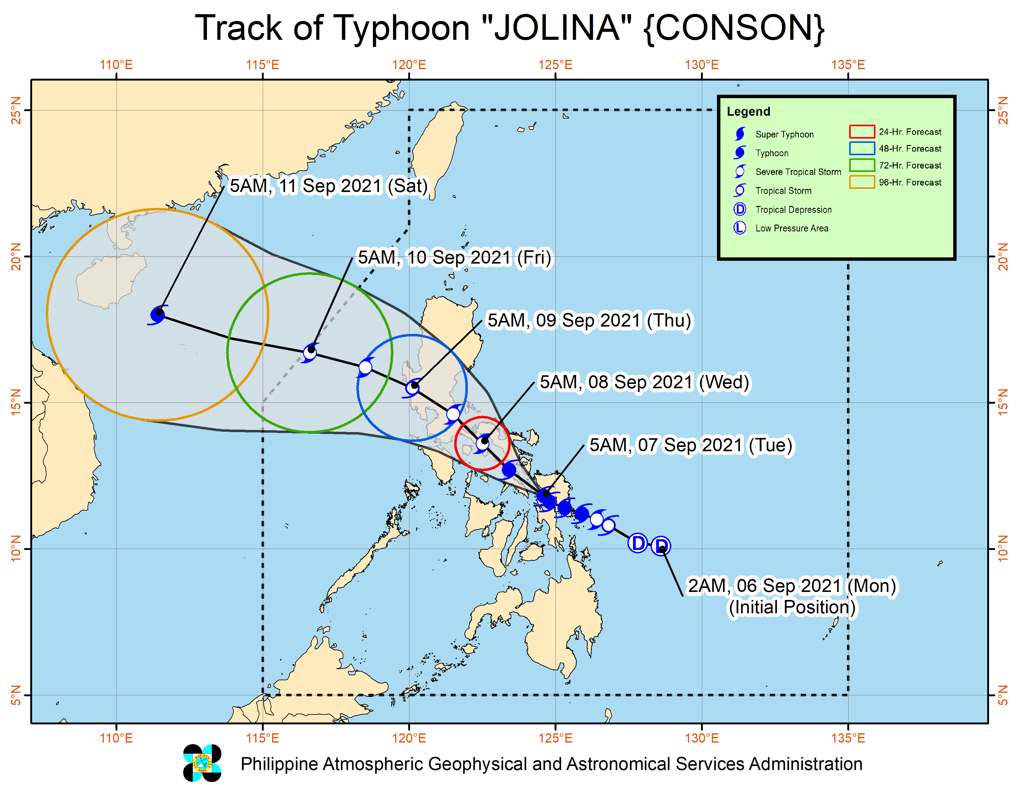
MANILA, Philippines — Tropical Cyclone Wind Signal No. 1 was raised in Metro Manila as Typhoon Jolina (Conson) continued to move over Samar Sea after making a fourth landfall on Tuesday morning.
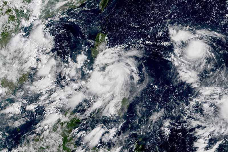
PAGASA said Jolina was over the coastal waters of Almagro in Samar, packing peak winds of 120 kilometers per hour near the center and gusts of up to 150 kph. It was heading west northwest at 15 kph.
Jolina has now made at least four landfalls: over Hernani in Eastern Samar, Daram in Samar and Santo Niño in Samar, and Almagro in Samar.
The state weather bureau raised tropical cyclone winds signals over the following areas:
TCWS No. 3
(Destructive typhoon-force winds prevailing or expected within 18 hours)
- Northern and eastern portions of Masbate (Pio V. Corpuz, Palanas, Cataingan, Placer, Dimasalang, Uson, Cawayan, Esperanza, Mobo, Aroroy, Baleno, City of Masbate, Mandaon, Milagros) including Ticao and Burias Islands
- Extreme western portion of Northern Samar (San Vicente, Capul, San Isidro, San Antonio)
- Northern portion of Biliran (Kaw ayan, Maripipi, Almeria)
- Northwestern portion of Samar (Santo Niño, Tagapul-An, Almagro, Calbayog City)
TCWS No. 2
(Damaging gale-force to storm-force winds prevailing or expected within 24 hours)
- Albay
- Sorsogon
- Rest of Masbate
- Western and southern portions of Camarines Sur (Del Gallego, Lupi, Ragay, Libmanan, Sipocot, Cabusao, Pasacao, Pamplona, Gainza, Camaligan, Canaman, Magarao, Bombon, Naga City, Pili, Ocampo, Iriga City, Sagñay, Buhi, Milaor, San Fernando, Minalabac, Bula, Nabua, Baao, Balatan, Bato, Calabanga)
- Western portion of Camarines Norte (Capalonga, Jose Panganiban, Labo, San Vicente, San Lorenzo Ruiz, Santa Elena)
- Marinduque
- Southern portion of Quezon (Tagkaw ayan, Guinayangan, Buenavista, Mulanay, San Narciso, San Francisco, San Andres, Catanauan, Calauag, General Luna, Lopez, Macalelon, Perez, Alabat, Quezon, Atimonan, Padre Burgos, Agdangan, Unisan, Pitogo, Gumaca, Plaridel)
- Eastern portion of Romblon (San Fernando, Magdiw ang, Cajidiocan, Romblon, Banton, Corcuera)
- Rest Biliran
- Western portion of Northern Samar (Silvino Lobos, Lope de Vega, Catarman, Bobon, San Jose, Rosario, Lavezares, Biri, Allen, Victoria, Mondragon)
- Rest of Samar
- Northern portion of Leyte (Calubian, San Isidro, Tabango, Leyte, Villaba, Matag-Ob, Kananga, Carigara, Jaro, Pastrana, Santa Fe, Tacloban City, Barugo, San Miguel, Alangalang, Tunga, Babatngon, Capoocan)
TCWS. No 1
(Strong winds prevailing or expected within 36 hours)
- Catanduanes
- Rest of Camarines Sur
- Rest of Camarines Norte
- Rest of Quezon including Polillo Islands
- Laguna
- Cavite
- Batangas
- Rizal
- Metro Manila
- Bulacan
- Rest of Romblon
- Oriental Mindoro
- Rest of Northern Samar
- Rest of Eastern Samar
- Rest of Leyte
- Northern portion of Southern Leyte (Silago, Bontoc, Sogod)
- Northern portion of Cebu (Carmen, Tuburan, Catmon, Sogod, Tabuelan, Borbon, Tabogon, San Remigio, City of Bogo, Medellin, Daanbantayan) including Camotes and Bantayan Islands
- Northeastern portion of Iloilo (Concepcion, Sara, San Dionisio, Batad, Estancia, Carles, Balasan)
- Northern portion of Aklan (Malay, Nabas, Ibajay, Tangalan, Makato, Numancia, Lezo, New Washington, Kalibo, Batan, Altavas)
- Northern portion of Capiz (Pilar, Panay, Roxas City, Sapi-An, Ivisan, Pontevedra, Panitan, President Roxas, Ma-Ayon)
What to expect
Heavy rainfall
- Jolina is expected to bring heavy to intense with at times torrential rains over Northern Samar, Eastern Samar, Samar, Leyte, Biliran, Sorsogon, Albay, Romblon and Masbate in the next 24 hours.
- Meanwhile, moderate to heavy with at times intense rains are also likely over the southern portion of Quezon, Occidental Mindoro, Oriental Mindoro, Marinduque and the rest of Bicol region and Visayas.
- PAGASA said scattered to widespread flooding (including flash floods) and rain-induced landslides are possible under these conditions.
Severe winds
- Destructive typhoon-force winds are likely to occur within any of the areas where Tropical Cyclone Wind Signal No. 3 is in effect. PAGASA said this may bring generally moderate to heavy damage to structures and vegetation.
- Meanwhile, damaging gale-force to storm-force winds are likely to occur within any of the areas where TCWS No. 2 is hoisted. This may bring generally light to moderate damage to structures and vegetation.
- Residents of areas under TCWS No. 1 will experience strong winds (strong breeze to near gale conditions). This may lead to very light damage to structures and vegetation.
Coastal inundation
- PAGASA warned the threat of coastal inundation due to storm surge of up to 0.5 to 1 meter will continue in several coastal localities of Biliran, Sorsogon, Samar and Masbate in the next 24 hours.
- Coastal areas of localities under TCWS may experience coastal flooding due to hazardous surf conditions.
Jolina is forecast to make landfall in the vicinity of Masbate within the next 12 hours.
Then, it will head northwest toward Burias Island and the vicinity of Ragay Gulf before making another landfall in the vicinity of southeastern Quezon tonight or early Wednesday morning. Prolonged interaction with land may result in its weakening into a severe tropical storm.


- Latest
- Trending


