


Fabian intensifies into typhoon
MANILA, Philippines — Fabian intensified into a typhoon yesterday afternoon as it hovered over extreme Northern Luzon, bringing monsoon rains over the country.
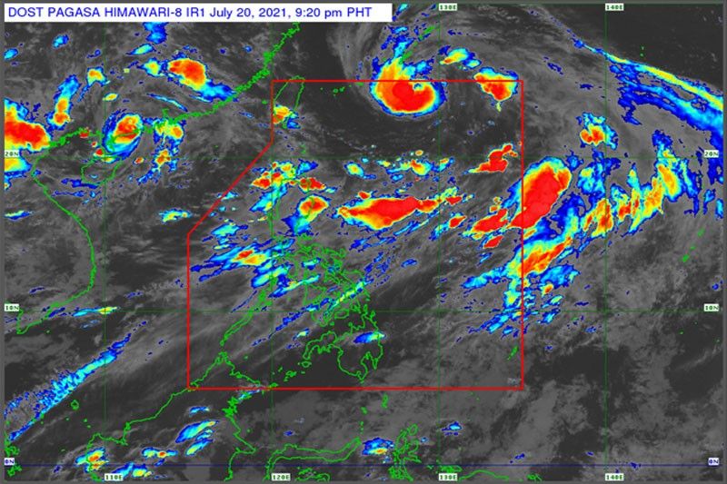
As of 4 p.m. yesterday, the eye of Fabian was estimated at 895 kilometers east northeast of extreme Northern Luzon, with maximum sustained winds of 120 kilometers per hour (kph) near the center and gustiness of up to 150 kph.
It was forecast to move west northwest at 15 kph, the Philippine Atmospheric, Geophysical and Astronomical Services Administration (PAGASA) said.
Apart from Fabian, Typhoon Cempaka, which was outside the Philippine area of responsibility, was also enhancing the southwest monsoon, according to PAGASA.
Monsoon rains will be experienced in the next 24 hours over Metro Manila, Ilocos region, Cordillera Administrative Region, Zambales, Bataan, Pampanga, Cavite, Batangas, Occidental Mindoro, northern Palawan, including Calamian and Cuyo Islands, Batanes and Babuyan Islands, PAGASA said in its 5 p.m. bulletin.
“The latest forecast scenario for Fabian shows that there is an increasing likelihood that Tropical Cyclone Wind Signal Number 1 may be hoisted over Batanes and Babuyan Islands,” the weather bureau said.
PAGASA said the enhanced southwest monsoon would also bring rough to very rough seas of up to 4.5 meters over the seaboards of Batanes, the northern seaboard of Cagayan, including Babuyan Islands, and the western seaboard of Palawan, including Kalayaan and Calamian Islands and Occidental Mindoro, including Lubang Islands.
“Sea travel is risky for small seacraft over these waters,” the agency said.
Fabian may further intensify and reach its peak intensity of 155 kph tomorrow evening or Friday early morning, according to PAGASA.
It was expected to move generally west until Friday.
“On the forecast track, the tropical cyclone will pass close to or make landfall in the vicinity of Yaeyama, Miyako and Senkaku Islands in the Ryukyu Archipelago on Thursday,” PAGASA said.
It was also expected to make landfall in the vicinity of northern Taiwan by Friday evening or Saturday early morning.


- Latest
- Trending


