


Tropical storm approaches PAR; brewing cyclone spotted off Mindanao
MANILA, Philippines — The weather disturbance approaching the country’s territory has intensified into a tropical storm as weather forecasters monitor another potential cyclone.
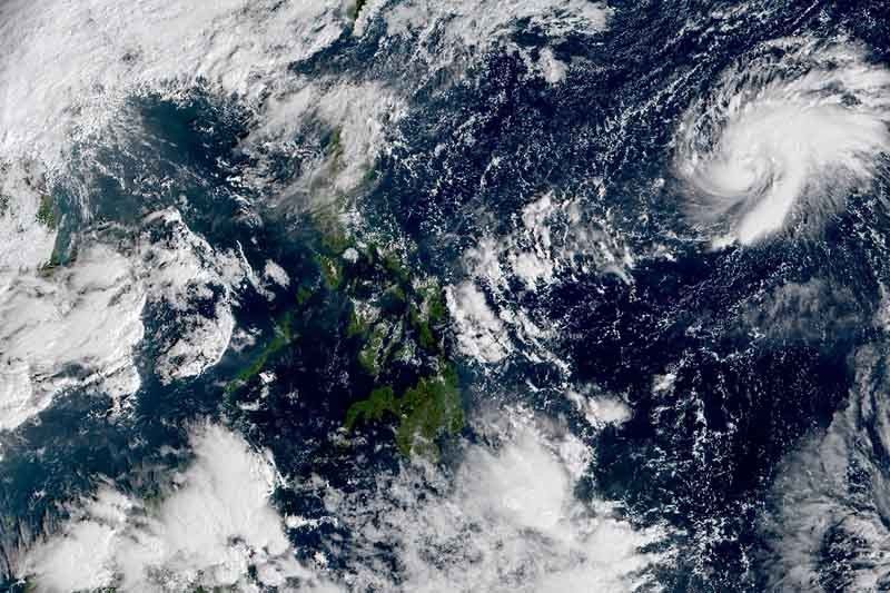
The tropical storm with international name “Goni” was last seen 1,705 kilometers east of Central Luzon, PAGASA weather specialist Ezra Bulquerin said. Moving west at 10 kilometers per hour, it may enter the Philippine Area of Responsibility Thursday morning or afternoon.
Once it does, the tropical storm will be locally called “Rolly”—the country’s 18th tropical cyclone for 2020.
Currently, “Goni” packs peak winds of 65 kph and gusts of up to 80 kph. Since it remains far from the Philippine landmass, it does not have any direct effect to the country for now, Bulquerin said.
According to the previous forecast of PAGASA, the cyclone could make landfall in Bicol region as a typhoon by Sunday. It could possibly take a path similar to that of Typhoon Quinta (international name: Molave).
Southern Luzon and some parts of Visayas are still reeling from the onslaught of Quinta, which brought strong winds and intense rainfall, killing at least nine people.
Brewing storm
As authorities in Luzon prepare for the approaching tropical cyclone, a low pressure area was also spotted outside PAR.
The LPA was seen 1,705 km east of Mindanao.
PAGASA’s Bulquerin said there is a chance that it will also enter PAR.
Early in October, the state weather bureau announced the onset of La Niña, which would dump more rains that usual. It is expected to persist until the first quarter of 2021. — Gaea Katreena Cabico


- Latest
- Trending


