


'Pepito' maintains strength with expected landfall tonight over Aurora, Isabela
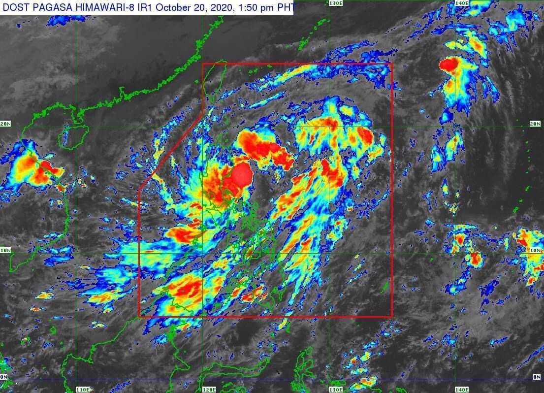
MANILA, Philippines — Tropical Storm Pepito has maintained its strength as it moves closer to Aurora-Isabela area where it is expected to make landfall tonight, PAGASA said.
The weather bureau in its latest bulletin said Pepito was last seen at 195 kilometers east of Baler, Aurora and is moving west northwestward at 25 kilometers per hour.
Its strength is still at 65 kph maximum sustained winds near the center, and gustiness of up to 80 kph.
PAGASA said "Pepito" is seen to exit the Philippine Area of Responsibility by Thursday morning, but may also intensify into a severe tropical storm by then.
At the same time, the agency said it is monitoring another tropical depression outside PAR which was seen at 1,735 km east northeast of extreme northern Luzon, with maximum sustained winds of 45 kph and gustiness of up to 55 kph.
PAGASA said the said weather disturbance, however, is less likely to enter the country.
"Pepito" will continue to bring moderate to heavy rains over Bicol Region, MIMAROPA, Quezon, Aurora, Nueva Ecija, Nueva Vizcaya, Qurino, Isabela, mainland Cagayan, Pangasinan and Benguet.
Metro Manila and the rest of Luzon, meanwhile, will see light to moderate with ocassional heavy rains, as well as those in Western Visayas, Zamboanga Peninsula and Bangsamoro.
Signal No. 2 remains in effect over the following areas, with PAGASA warning that winds of greater than 61 kph and up to 120 kph may be experienced in at least 24 hours:
- La Union
- Ifugao
- Benguet
- Nueva Vizcaya
- Quirino
- Pangasinan
- Nueva Ecija
- Tarlac
- Aurora
- southern portion of Isabela (Palanan, San Mariano, Benito Soliven, Naguilian, Gamu, Burgos, San Manuel, Aurora, Cabatuan, Luna, Reina Mercedes, Cauayan City, Dinapigue, San Guillermo, Angadanan, Alicia, San Mateo, Ramon, San Isidro, Echague, San Agustin, Jones, Santiago City, Cordon)
- southern portion of Ilocos Sur (Sugpon, Alilem, Tagudin)
- northern portion of Zambales (Iba, Palauig, Masinloc, Candelaria, Santa Cruz, Botolan, Cabangan)
- northern portion of Quezon (General Nakar)
Gale warning is also still in effect over seaboards of Batanes, Cagayan and Ilocos Norte with rough to very rough seas of wave height reaching 2.8 to 5 meters.
The agency added that moderate to rought seas will prevail too over the western and eastern seaboards of southern Luzon, as well as the eastern seaboards of Eastern Visayas, Caraga and Davao Region.
Forecast Position
- Wednesday morning: 205 km west of Dagupan City, Pangasinan
- Thursday morning:510 km west of Dagupan City, Pangasinan
- Friday morning: 660 km west of Dagupan City, Pangasinan
- Saturday morning:905 km west of northern Luzon — Christian Deiparine


- Latest
- Trending


